Ngāi Tahu – Cultural Mapping Project

Māori place names of Banks Peninsula

Department of Lands & Survey, c.1948

The Department of Lands and Survey created this map of Māori place names of Banks Peninsula around 1948. The map incorporates Māori place names and Māori land information collected by Pākehā ethnographers from documentary and oral sources dating from the mid-19th century through to the 1940s. The majority of the place names were recorded from Ngāi Tahu informants by Revd. James West Stack between 1860 and 1890. Additional names were sourced from Johannes Andersen, W.H.S. Roberts, and William Anderson Taylor. The names of the Ngāi Tahu individuals who provided the information in the first place were not specifically recorded, however it is possible to ascertain that the following Ngāi Tahu were among the contributors: Hakopa te Ata o Tu, Tamati Tikao, Rahera Tikao, Aperahama Te Aika, Wiremu Karaweko, Teone Taare Tikao, and Teoti Rapatini (George Robinson).

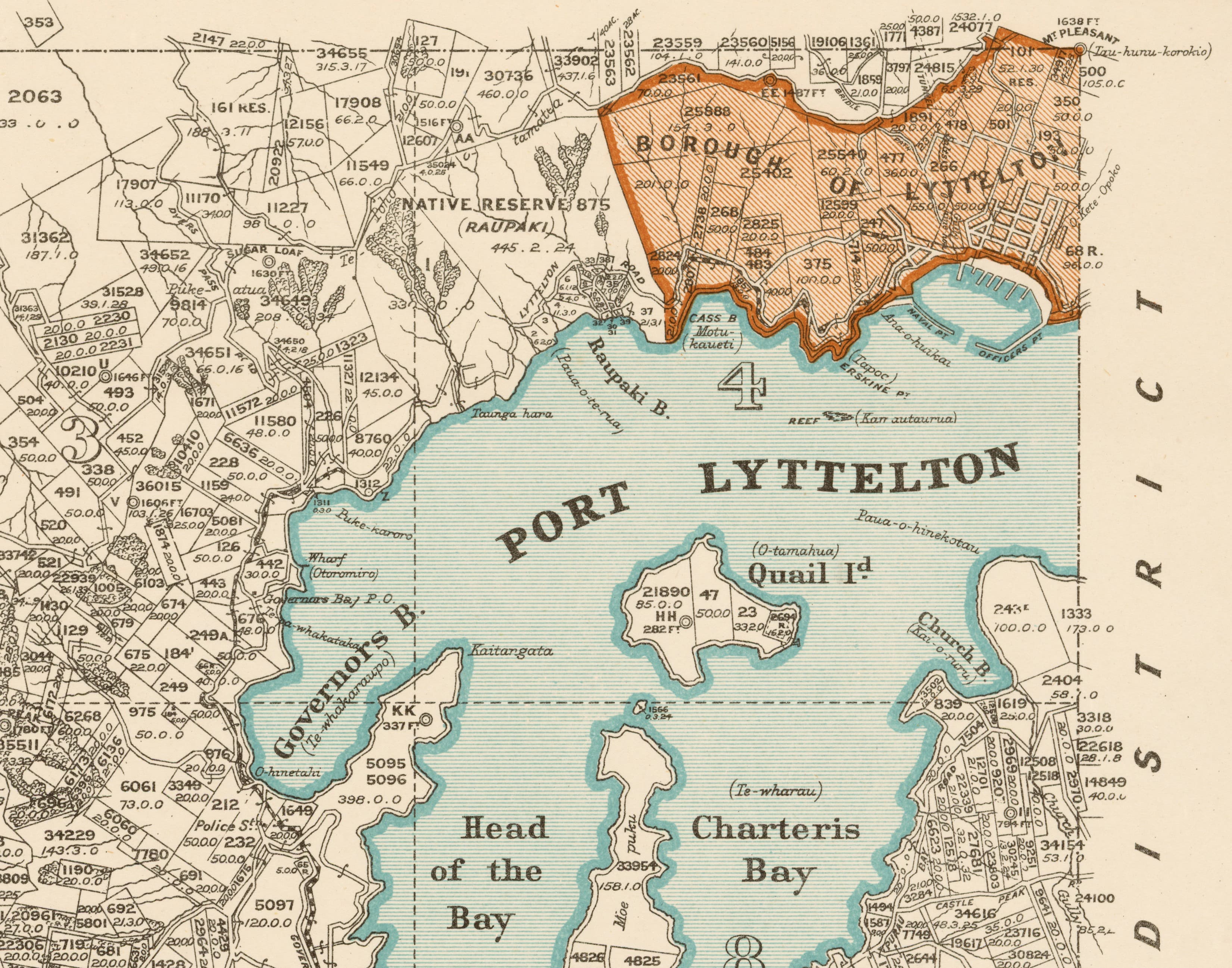
Māori place names of Banks Peninsula and the Department of Lands & Survey

The collecting and mapping of the Māori place names of Banks Peninsula dates back to the earliest period of surveying and mapping in New Zealand. In 1770 James Cook on board the Endeavour sighted Banks Peninsula and concluded it was an island. This error was not corrected until 1809 by William Stewart on board the Pegasus. In 1843 Auguste Berard on board the Rhin charted Banks Peninsula for the first time. This chart and numerous subsequent maps of the peninsula retained some Māori place names but increasingly overwrote the cartographic landscape with names of European origin.

European explorers, adventurers, scientists, and exploiters of natural resources conducted survey work and constructed maps throughout Te Waipounamu and wider New Zealand. Many were assisted by Māori who had a detailed ‘cartographic’ knowledge of the shape and form of the land long before Europeans arrived.

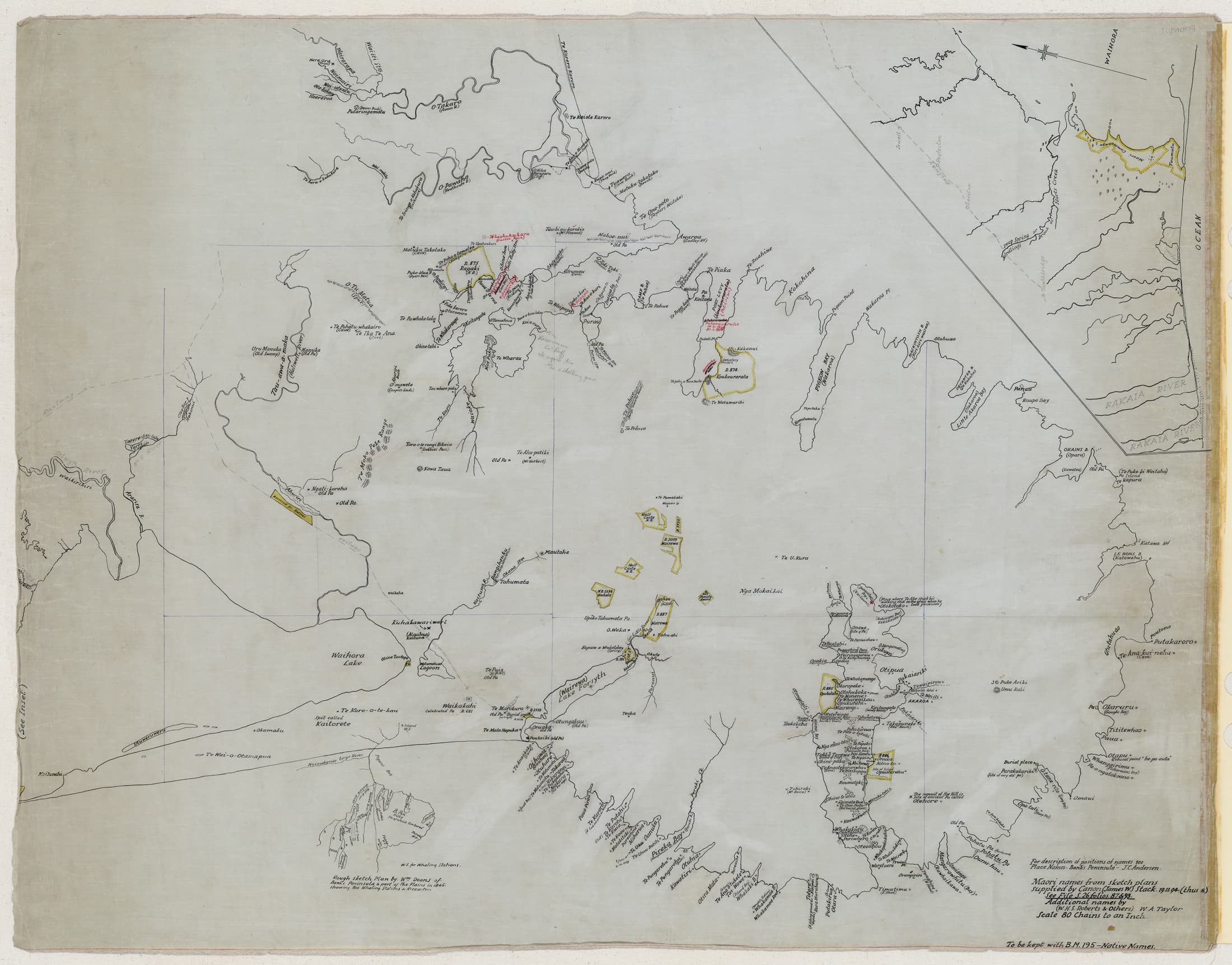
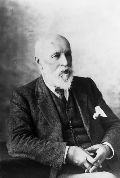
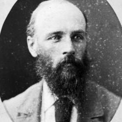
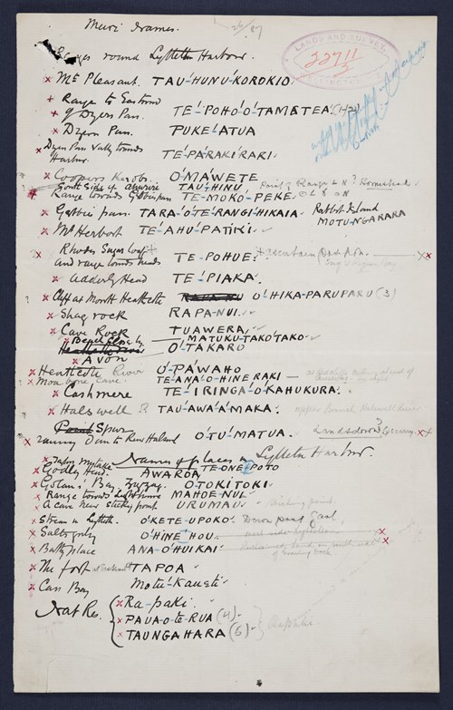
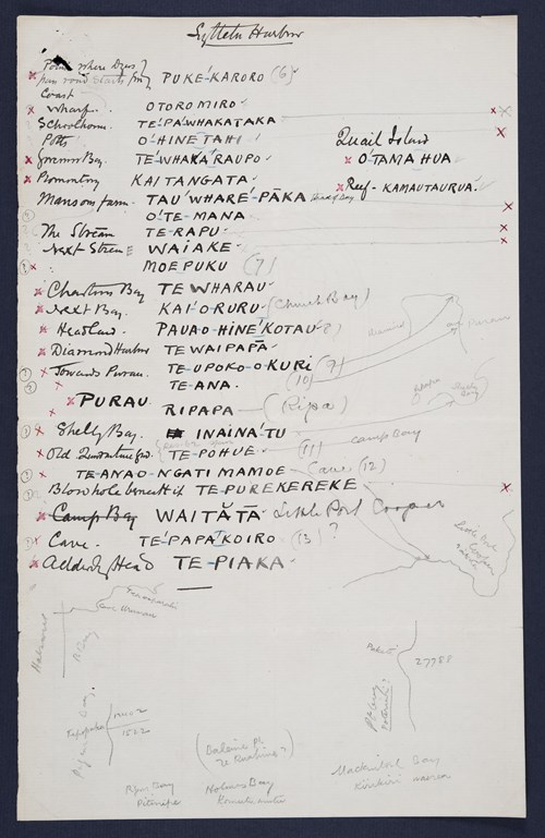
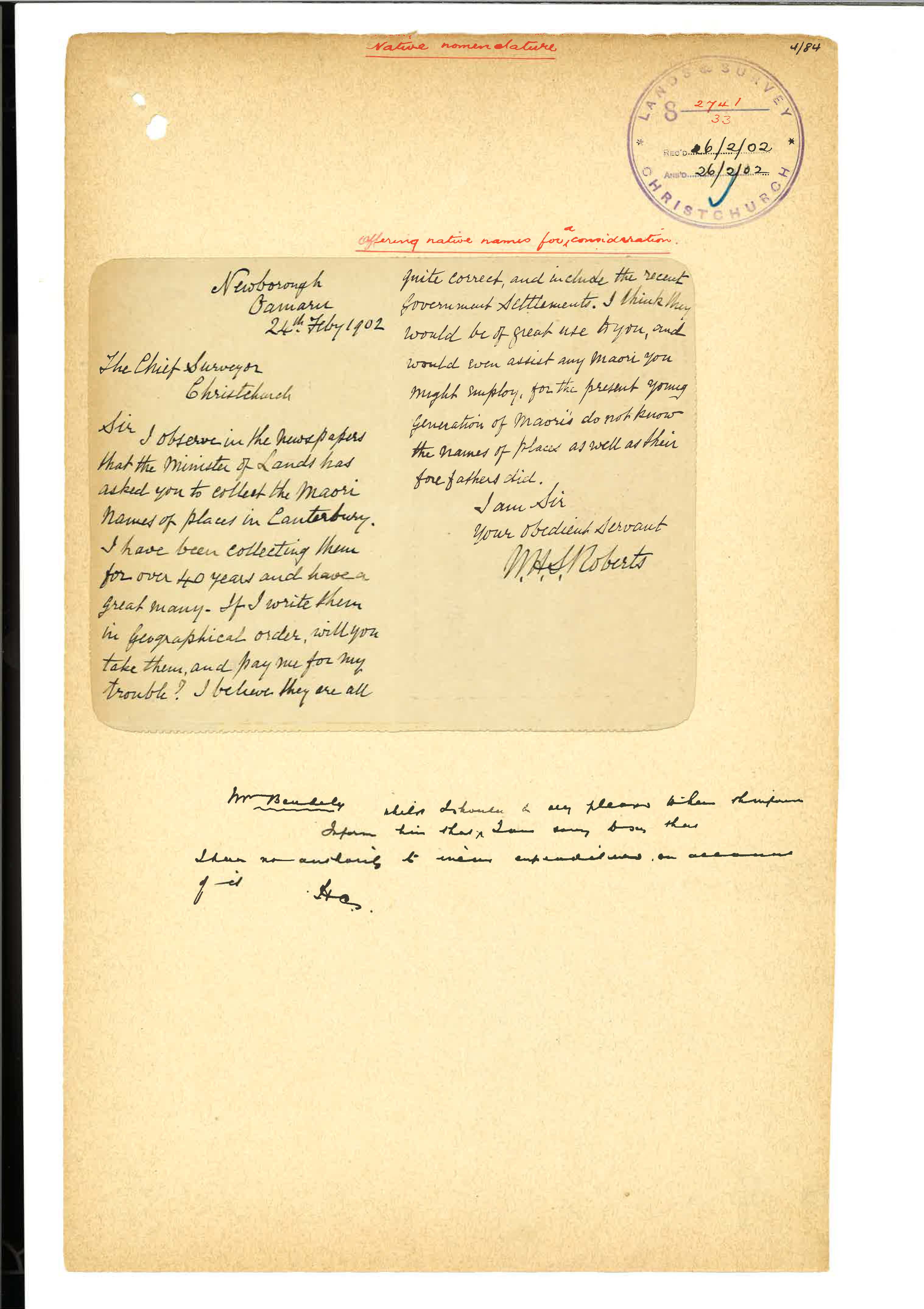
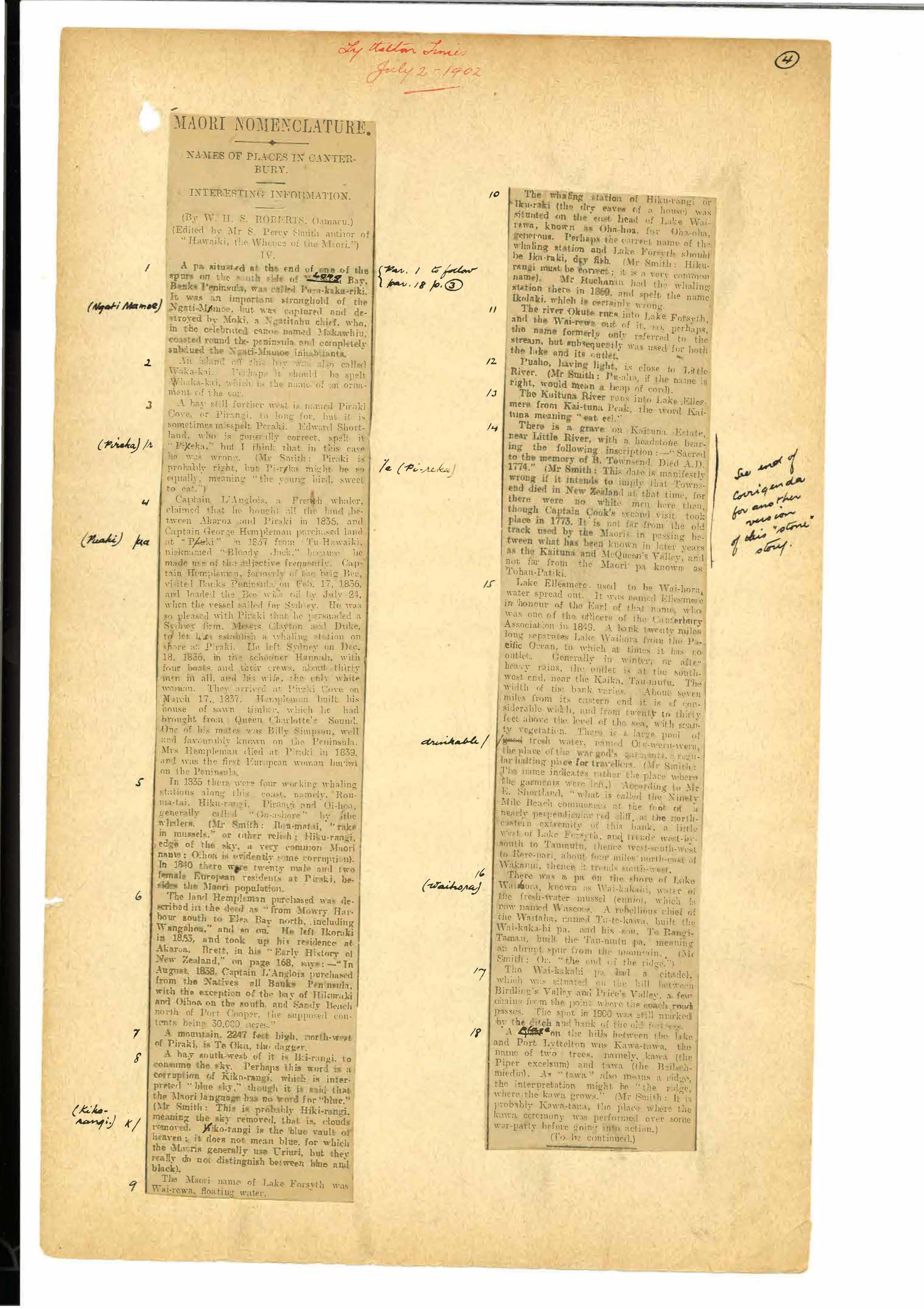
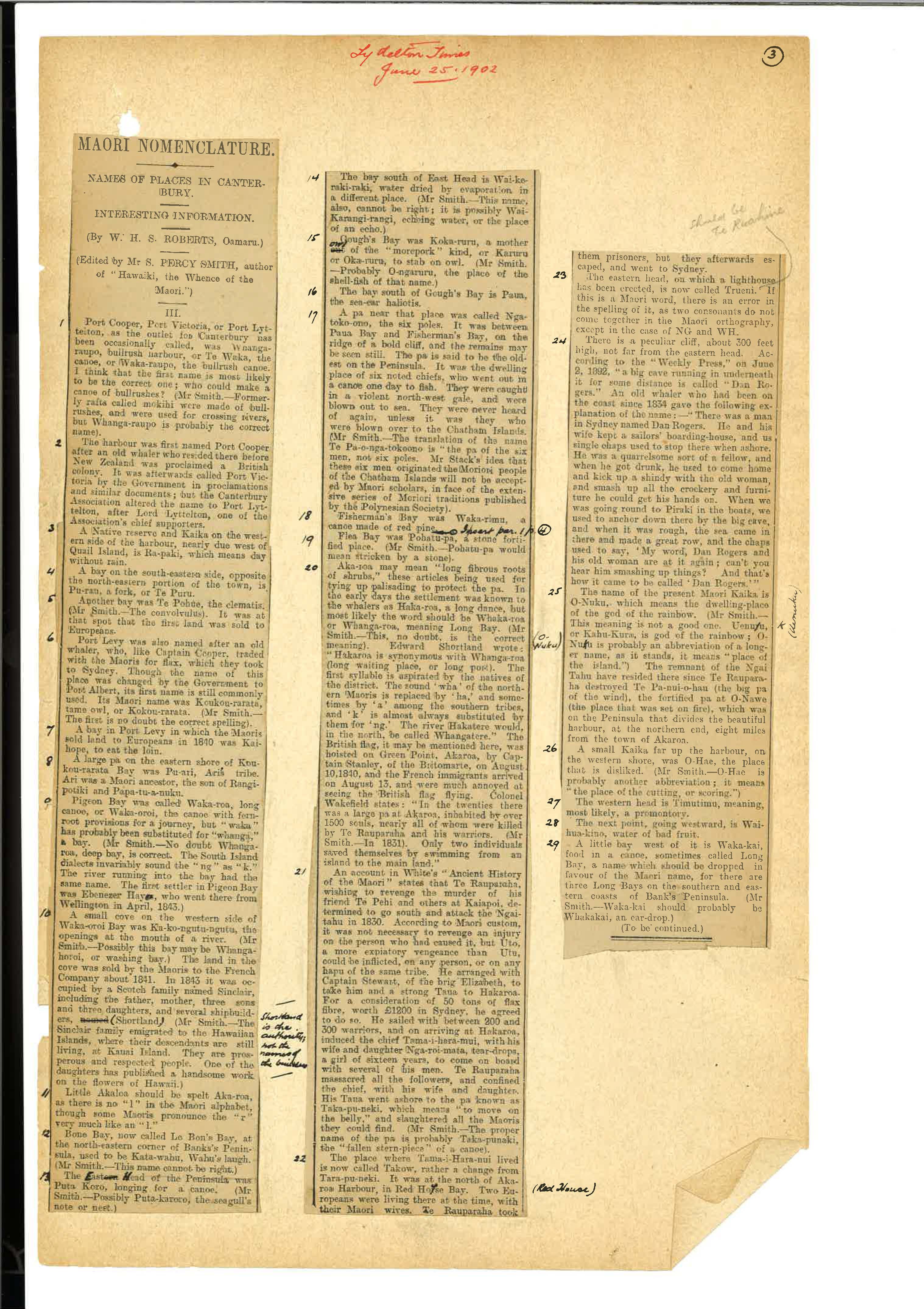
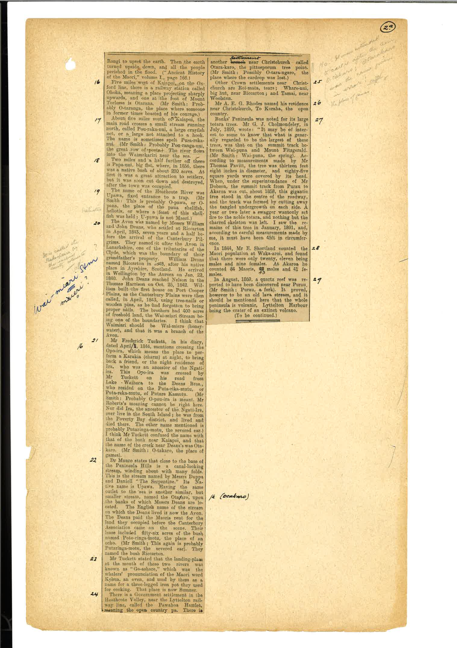
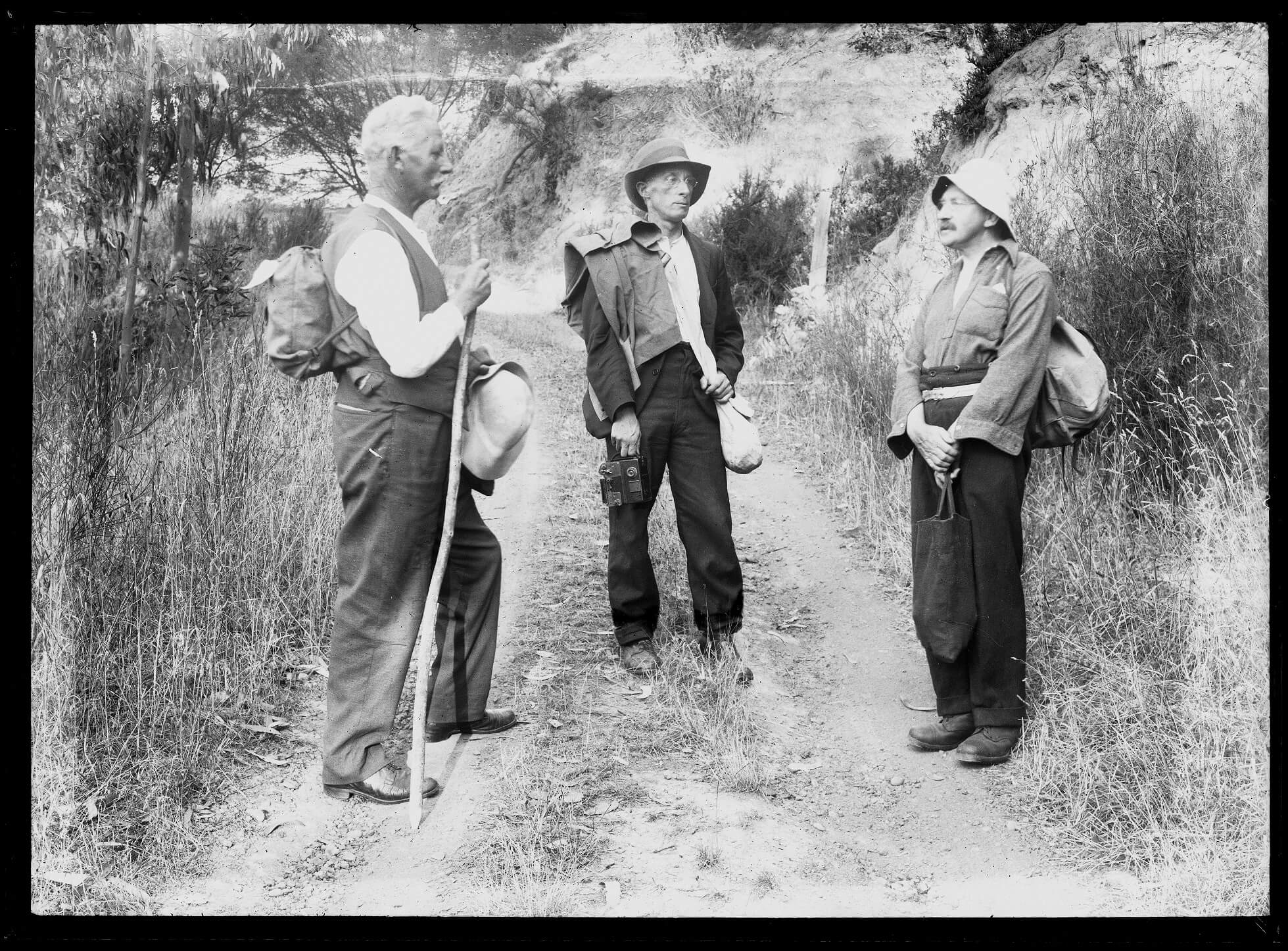
In 1893 the Surveyor General Stevenson Percy Smith wrote to John William Allman Marchant (Chief Surveyor Canterbury) in Christchurch directing him and his staff to actively collect and preserve Māori place names. Smith's directive led to a flurry of activity in the Christchurch office of Lands and Survey resulting in the collation of several significant lists of Māori place names in the Canterbury district that have been drawn upon by map makers and scholars ever since. A large number of Māori place names, including many on Banks Peninsula, became part of the government’s cartographic record for the first time. Some of these names are perpetuated on our maps today and others still have been afforded official place name status by the New Zealand Geographic Board. 

Stephenson Percy Smith (1840-1922) was appointed Surveyor General in 1889 and held this position until 1901 when he retired. Smith had immigrated to New Zealand from England as a child and grew up on the family farm in Taranaki. He trained as a surveyor and developed a keen interest in Māori history and culture. In 1892 he was a co-founder with Edward Tregear of the Polynesian Society and was co-editor of the Journal of the Polynesian Society and its chief contributor until his death in 1922. In his role as Surveyor General he strongly promoted the preservation of Māori place names.

'It is constantly brought under the notice of the department the necessity that exists for preserving the original Maori names of physical features wherever they exist and can be obtained. I have to request that you will, as far as lays in your power, endeavour to carry out what seems to be a generally expressed public wish that such names should be preserved on the record maps of the Colony. The best plan whereby to preserve these names will be wherever possible to secure it by publication on the 80 chain maps published by this Department. I would also request that wherever possible you should get such native names verified by natives themselves or by native experts wherever you have an opportunity.'

S. Percy Smith, Surveyor General to the Chief Surveyor, Christchurch, 15 November 1893

Māori place names collected by Revd. James West Stack

In 1894 as part of his drive to record Māori place names the Surveyor-General, Stephenson Percy Smith asked Reverend James West Stack (1835-1919) to provide him with a list of Māori place names in the Canterbury District. Smith wanted to include more Māori names on the official maps being produced by his Department. His initial focus was the Halswell Survey District which encompassed Whakaraupō (Lyttelton Harbour).

Stack sent Smith a list of names he had collected over many years of living and working with Ngāi Tahu communities. Smith shared this list with John William Allman Marchant (Chief Surveyor Canterbury) who then worked directly with Stack to fix the names at the correct points on the map. Stack also advised Marchant to make contact with Teone Taare Tikao for further checking.

A few months later, Stack sent additional lists of names to Marchant in the form of four detailed maps of areas around Banks Peninsula. These lists and sketch maps constitute the bulk of the place name data that was collated by the Department of Lands and Survey to create the Māori place names of Banks Peninsula map that features on this page.

James West Stack was a an Anglican missionary, clergyman, writer, and interpreter. He was employed by the Church Missionary Society and ordained in 1860. He served as a Minister at Tuahiwi, Duvauchelles, Kaiapoi and Fendalton. Stack made a significant contribution to the preservation of Māori place names, arguing from his knowledge of local tradition that 'Every part of the country was owned and named'.

James West Stack, Alexander Turnbull Library PA2-2781

View Stack's original lists and maps of Māori place names of Banks Peninsula below.

<p>List of place names in Whakaraupō (Lyttelton Harbour) 
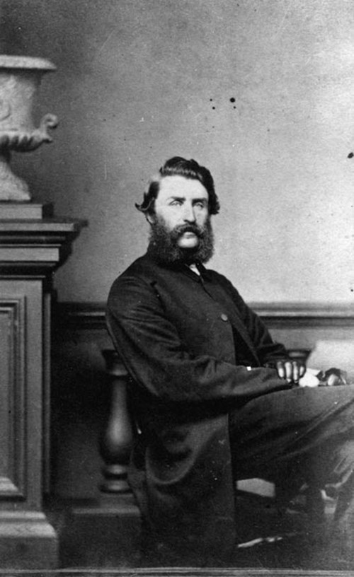
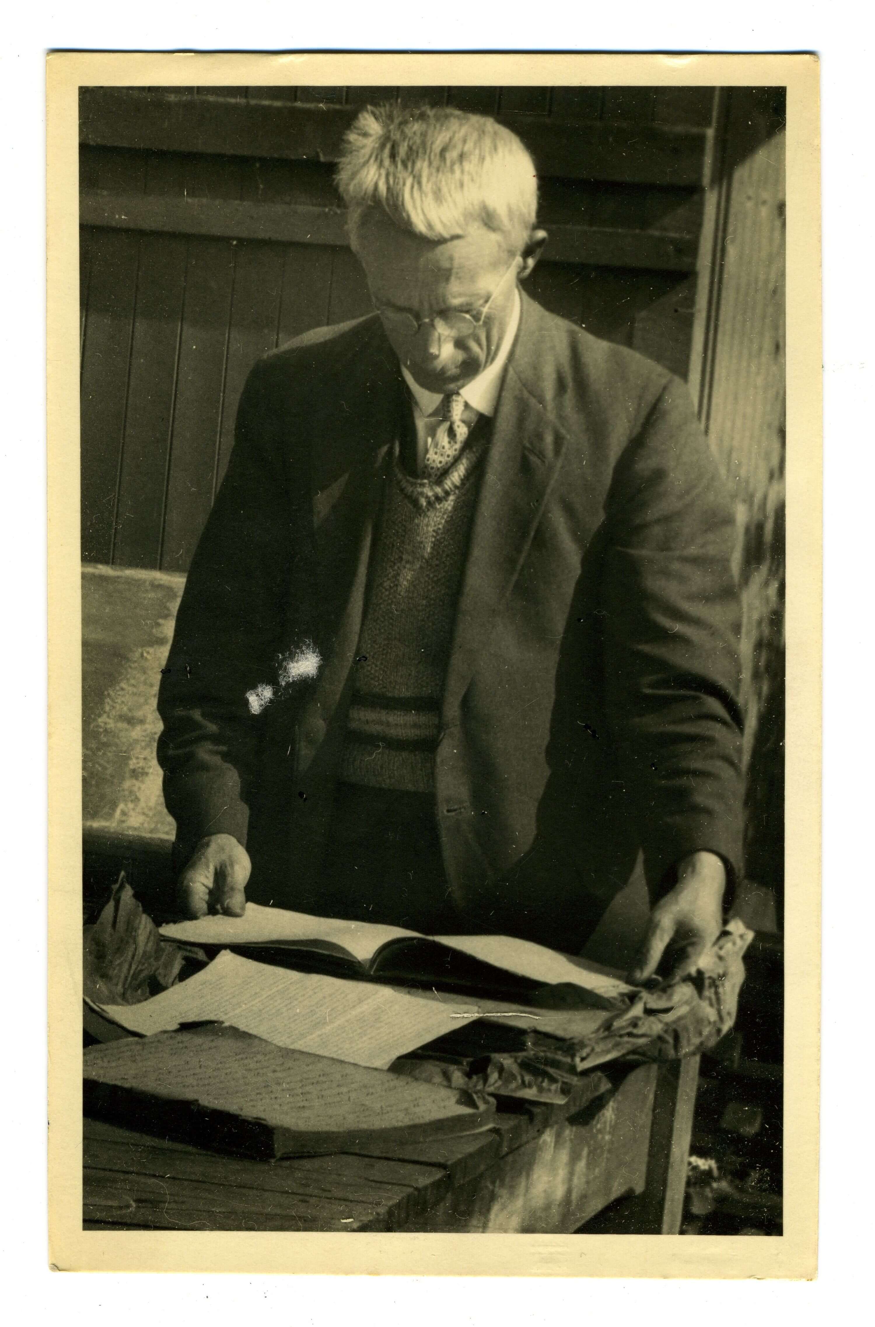
sent by Revd. James West Stack to the Surveyor General, Stephenson Percy Smith in April 1894.&nbsp;</p>
<p><em>Archives New Zealand, S26</em></p>
<p>Click <a rel="noopener" href="https://kareao.nz/scripts/mwimain.dll/144/ANON_DESCRIPTION/WEB_DETAIL_DESCRIPTION_REPORT?SESSIONSEARCH&amp;exp=sisn%2015168" target="_blank" title="Stack lists">here</a> to view these lists in Kareao</p>

James West Stack to Department of Lands and Survey 1893-94

View gallery

A selection of the Māori place names provided by Stack in 1894 were added to the lithographic maps of the survey districts of Banks Peninsula produced by the Department of Lands and Survey in subsequent years.

View detail of the map of Halswell Survey District (1912) below. The majority of the Māori place names within Whakaraupō (Lyttelton harbour) that appear on this map originate from Stack. Most of these Māori place names still feature on contemporary maps of the harbour today. 

Additional names by William Henry Sherwood Roberts

After Stephenson Percy Smith retired as Surveyor General in 1900 the Department of Lands and Survey maintained its strong interest in the preservation of Māori place names. A specific regulation in the General Instructions to Officers of the Department of Lands and Survey stated that 'the original Maori names of places are to be preserved as far as possible.'

In 1901 the Christchurch Member of Parliament Harry Ell (of Summit Road fame) publicly advocated for more work to be done throughout the country on the collection and preservation of Māori place names. Ell and other Members of Parliament raised this issue at the opening of Te Wheke, the Rūnanga hall at Rāpaki in December 1901 and at subsequent hui held at Kaiapoi and Wairewa (Little River) in 1902. The Minister of Lands, Thomas Young Duncan emphasised the importance of gathering place name information directly from 'the surviving natives' wherever possible.

The Crown's attention to place name preservation in Canterbury was widely reported in the Canterbury newspapers prompting William Henry Sherwood Roberts (1834 - 1917) to make contact with the Department of Lands and Survey in 1902 offering his services. By this time Roberts had been collecting Māori place names and associated information for more than forty years. Roberts was a pioneer in the filed of toponymy - the study of place names. His work inspired James Herries Beattie after him, though unlike Beattie, Roberts did not interact directly with Ngāi Tahu informants, but rather relied upon documentary sources. 

Roberts initially sought payment from the Department for delivery of his research but was quickly advised that there was no budget available. Instead, Stephenson Percy Smith agreed to edit Roberts material which was published as a series of articles in the Lyttelton Times between June and September 1902. 

Roberts sent annotated copies of the newspaper articles (including his corrections of numerous printing errors) to the Department of Lands and Survey for their files. Forty years later, some of these place names were subsequently added to the Māori place names of Banks Peninsula map.

William Henry Sherwood Roberts was born in Wales in 1834. He immigrated to New Zealand on the 'John Phillips' in 1855. He lost his cattle run near Invercargill in 1859, and in 1871 lost his sheep run at Tapanui. Settling in Oamaru, Roberts became an auctioneer and agent. He also became a member of the Oamaru Borough Council (1879), the hospital committee (1882) and the Otago Anglican Synod. He published several historical works, including 'Maori Nomenclature', and published collections in New Zealand newspapers including the Otago Daily Times and the Lyttelton Times. Roberts married Emma Williams in 1867. He died on 22 January 1917.

View Roberts's cover letter and annotated newspaper clippings below.

<p>In 1902 W.H.S. Roberts&nbsp;read in the newspaper that the Chief Surveyor Canterbury had been directed to collect Māori place names in the region. Roberts, a collector of Māori place names for over forty years,&nbsp; wrote to the Chief Surveyor offering his services.&nbsp;</p>
<p>W.H.S. Roberts to the Chief Surveyor, Christchurch, 26 February 1902,<em> Archives New Zealand, R16636398</em></p>
<p>&nbsp;</p>

W.H.S. Roberts to Department of Lands and Survey 1902

View gallery

'The Surveyor General has again reminded the Chief Surveyor and asked him to do whatever is possible to follow up and ascertain from the surviving natives all the information possible in connection with the original names of places in Canterbury.'

T.Y. Duncan, Minister for Lands, in Press 19 March 1903

Place-names of Banks Peninsula by Johannes Andersen

Johannes Andersen (1873 – 1962) started working for the Department of Lands and Survey in Christchurch in 1887 and remained there until 1915. During this period he acquired a wealth of topographical knowledge and developed an avid interest in toponymy – the study of place names, both Māori and Pākehā.

In 1902 when the Christchurch Member of Parliament Harry Ell suggested that the Department of Lands and Survey ought to develop a ‘topographical dictionary’ of the Canterbury district as a guide book for tourists, the Commissioner of Crown Lands Sidney Weetman agreed that Andersen could undertake this work at intervals when his other commitments were not pressing.

Twenty-five years passed before Andersen’s topographical history was eventually published. By this time his focus had narrowed to Banks Peninsula. Andersen’s Place-names of Banks Peninsula: A topographical history was published in 1927. At the time of publication Andersen was the librarian at the Parliamentary Library in Wellington and was a prolific author, specialising in Māori and Polynesian culture and history. Most of the Māori place name information in Andersen’s book was drawn from maps and correspondence he accessed during his tenure at the Department of Lands and Survey in Christchurch. Several of the source documents used by Andersen are featured on the Ka Huru Manu website including the map of the southern bays of Banks Peninsula by Hoani Te Hau Pere, the map of Akaroa by Teone Taare Tikao, and Revd. James West Stack's lists and maps.

An annotation on the Maori place names of Banks Peninsula map directs readers to consult Andersen's 1927 book to identify the exact locations of the place names recorded.

Johannes Andersen. Photograph by Stanley P. Andrew, Alexander Turnbull Library, 1/1-018551;F

‘In the place names of a country large parts of its history are embalmed…the names persist longer than the beings who gave them.’

Johannes Andersen in Place names of Banks Peninsula, 1927

Contributions from William Anderson Taylor

William Anderson Taylor (1882 - 1951) was a photographer and amateur historian who had a lifelong interest in Māori history and culture. He began compiling ‘Māori history notes’ around 1910 – a practice that led to his eventual compilation of over one hundred notebooks and scrapbooks dedicated to historical subjects. His sources included early colonial records (including maps and correspondence), historic newspapers, and interviews with Ngāi Tahu people. His many Ngāi Tahu friends and acquaintances knew him as Wiremu Teira. 

The exact nature of Taylor's contribution to the Māori place names of Banks Peninsula map is unclear however the annotation confirms that he contributed to its creation. Taylor worked voluntarily at the Christchurch branch of the Lands and Survey Department in Christchurch from 1936 to 1941 classifying and ordering the records of the Canterbury Provincial Government and the Canterbury Association. In 1940 the Department of Internal Affairs sought his assistance with the compilation and checking of a map of Māori place names of Banks Peninsula for inclusion in a planned New Zealand Centennial Atlas. The Atlas project did not proceed and was cancelled later that year. Taylor was pleased that he had at least been able to contribute some additional place names that would go on the record for posterity. The Māori place names of Banks Peninsula map featured on this page is almost certainly a variant of the map that Taylor worked on in 1940.

Taylor had a particular interest in Banks Peninsula and published a booklet on the subject in 1937 (Banks Peninsula Picturesque and Historic). He wrote newspaper articles about aspects of the peninsula and its history and was a regular visitor to the Ngāi Tahu kāinga at Te Mata Hāpuka, Wairewa, and Taumutu. He also personally knew every hill, bay, and stretch of coastline, having walked or cycled its length and breadth over many years taking photographs.

 William Anderson Taylor viewing the original manuscript of Captain George Hempleman of Peraki. Hocken Library, University of Otago, PC1051/B3511

'When I was helping the Survey with the Maori places on Banks Peninsula on a blank map I found I had to watch my marks very often even though I had viewed its entire coastline.'

William Anderson Taylor to James Herries Beattie, 4 April 1942

View a selection of Taylor's photographs of Banks Peninsula in the gallery below.

<p><span>William Anderson Taylor had a life-long love of&nbsp;Banks Peninsula&nbsp;where he spent much of his spare time exploring by bicycle&nbsp;or on foot. He was always armed with a camera. Numerous rocky outcrops,&nbsp;hills,and bays are&nbsp;featured in his encyclopedic collection of Banks Peninsula photographs held at the Canterbury Museum.</span></p>
<p><span>Alfred Patterson Osborne, William Taylor and J.L. Martin, Banks Peninsula, c1930.&nbsp;<em><span>W.A. Taylor photograph,&nbsp;Canterbury Museum, 1968.213.3950</span></em></span></p>
<p>&nbsp;</p>

W.A. Taylor photographs of Banks Peninsula

View gallery

Ngāi Tahu contributors to the Māori place names of Banks Peninsula map

The names of the Ngāi Tahu individuals who provided the place-name information for the Māori place names of Banks Peninsula map are not specifically recorded. However, from our knowledge of the Pākehā 'collectors' it is possible to ascertain some of the tipuna from whom the information was originally derived. They include  Hakopa te Ata o Tu, Tamati Tikao, Rahera Tikao, Aperahama Te Aika, Wiremu Karaweko, Teone Taare Tikao, and Teoti Rapatini (George Robinson).

Read about these tipuna in the gallery below.

<p>Aperahama Te Aika (c.1809-1889) 
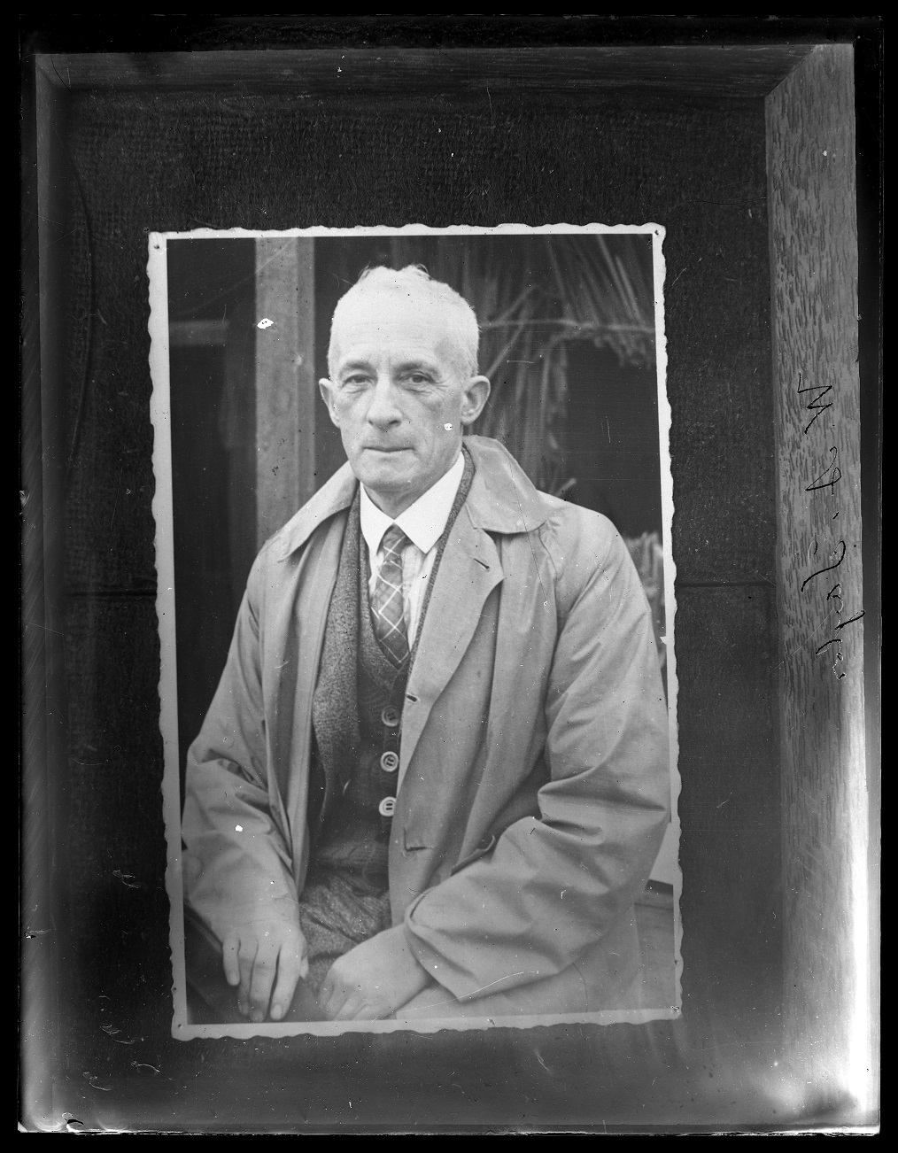
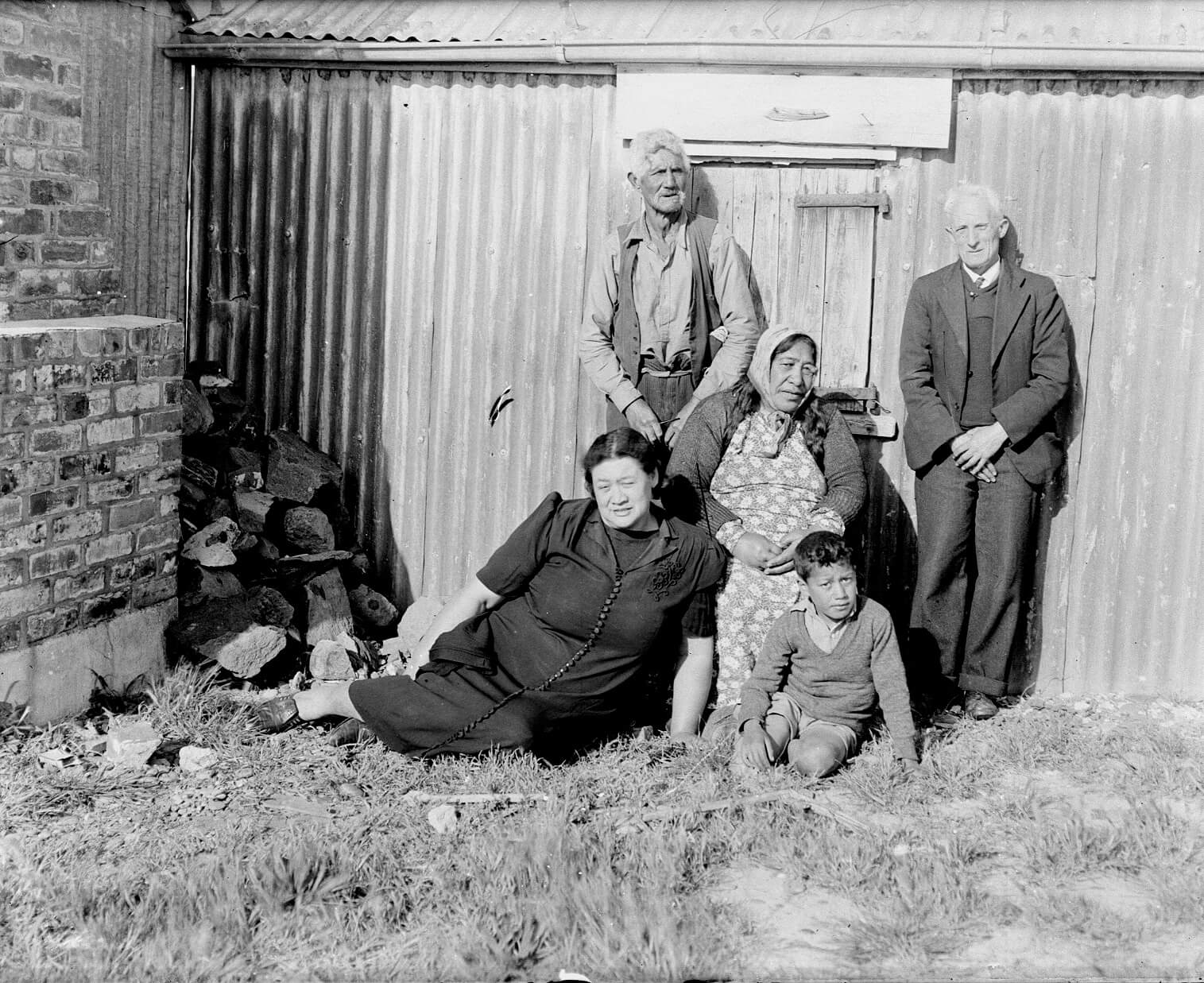
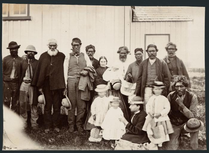
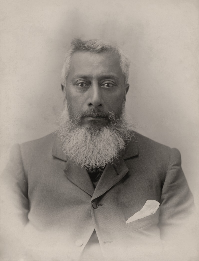
(standing far right) from Tuahiwi was among the Ngāi Tahu who provided historical information to James West Stack for his chapter 'Maori history of Banks Peninsula' published&nbsp;in H.C. Jacobson's 1883 volume,&nbsp;Tales of Banks Peninsula.&nbsp;Many of the place names Stack&nbsp;used in&nbsp;this 1883 text&nbsp;were subsequently provided by him to the Department of Lands and Survey in 1894. Stack's information was the major source used by the Department of Lands and Survey to compile the Māori place names of Banks Peninsula map in the 1940s.&nbsp;</p>
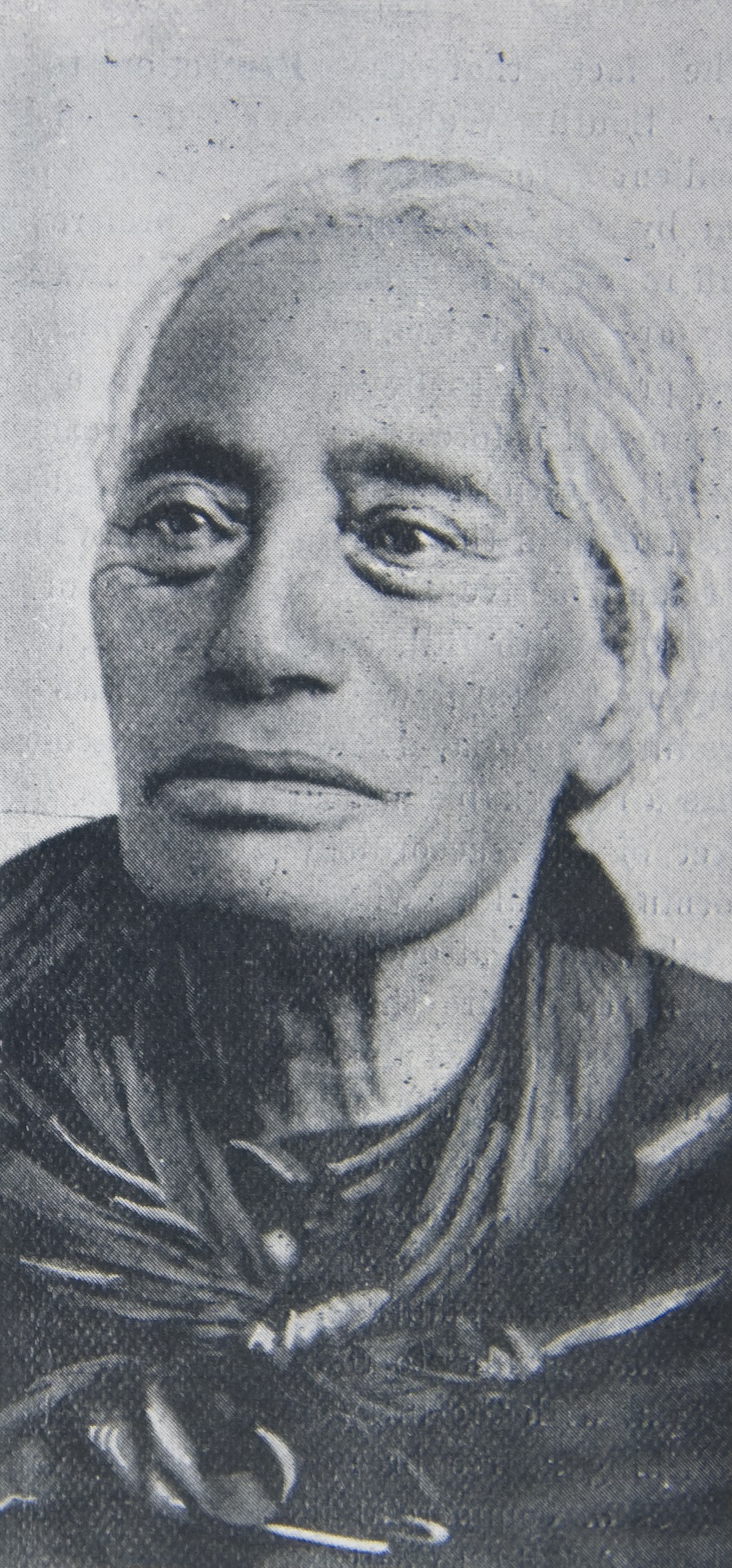
<p>Te Aika was a Ngāi Tūāhuriri chief and a survivor of the Ngāti Toa attack on&nbsp;Kaiapoi pā. He had an extensive knowledge of Ngāi Tahu lore and was renowned for his powers of oratory.</p>
<p>South Island Māori converts to Christianity including Arapata Koti (third from left), Aperahama Te Aika (standing far right), Pita Te Hori (standing third from right), with Eliza Stack (centre), wife of the Rev. James Stack, outside St Stephen's Church, Tuahiwi. Photograph taken 1867 by Dr A C Barker. Alexander Turnbull Library, PA7-01-23</p>
<p class="byline">Click <a rel="noopener" href="https://kareao.nz/scripts/mwimain.dll/144/ANON_DESCRIPTION/WEB_DETAIL_DESCRIPTION_REPORT?SESSIONSEARCH&amp;exp=sisn%2040904" target="_blank" title="St Stephens Church image">here</a> to view image on Kareao.</p>

Ngāi Tahu contributors to the Māori place names of Banks Peninsula map

View gallery
<p>Kaitorete is the wide shingle spit that separates Te Waihora (Lake Ellesmere) 
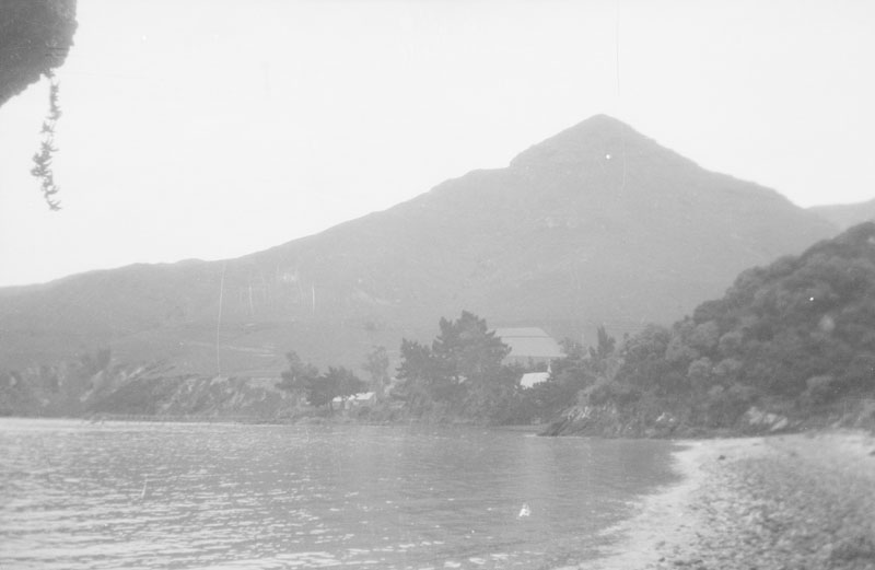
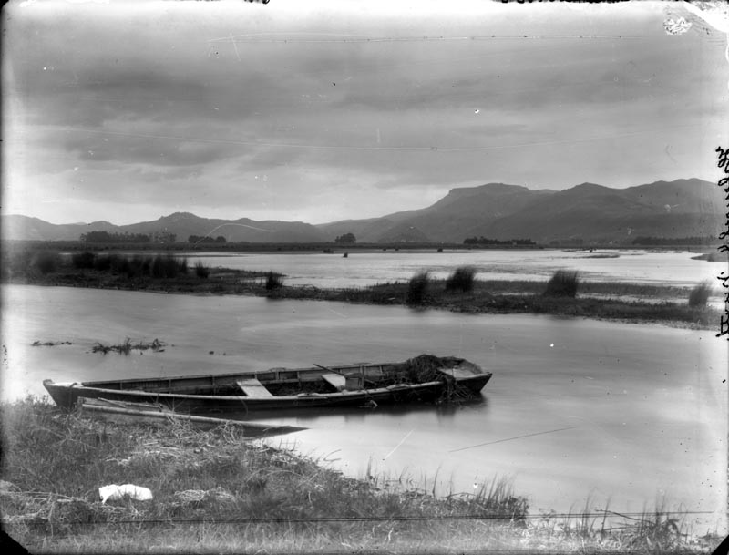
from Te Moana-nui-a-Kiwa (the Pacific Ocean). Extending from the foot of Horomaka/Te Pātaka-a-Rākaihautū (Banks Peninsula) at Wairewa in the north to Taumutu to the south, Kaitorete was part of a key travel route for Ngāi Tahu. It proved much easier to access than navigating inland around the swampy edges of Te Waihora, which covered twice the area that it does today. Kaitorete was an important source of mahinga kai, and is a tribally-renowned source of the endemic golden sand sedge, pīngao (Ficinia spiralis), a fibrous plant used for weaving. In former times, channels were dug from Te Waihora into the spit for tuna (eels) to enter during their migration. In 1868 Ngāi Tahu claimed ownership of Kaitorete during the 1868 Native Land Court hearings in Christchurch, on the basis that it was a place of occupation for their ancestors and that it had never been sold. Although Judge Francis Dart Fenton dismissed the claim, stating that Kemp's Deed included Kaitorete, he acknowledged the importance of Kaitorete to Ngāi Tahu.<em> Te Rūnanga o Ngāi Tahu Collection, Ngāi Tahu Archive, 2018-0311</em></p>

Selected Māori place names of Banks Peninsula

View gallery