Ngāi Tahu – Cultural Mapping Project

The Ninety Mile Beach – A Māori Highway

Wairewa to Waitarakao

The Ngāi Tahu coastal travel route between lakes Wairewa and Waitarakao (Washdyke Lagoon) was once the equivalent of a Māori State Highway One connecting the settlements of Te Pātaka-o-Rākaihautū (Banks Peninsula) with coastal kāinga to the south, including the famous Te Waiateruatī pā. Named the ‘ninety mile beach’ by Pākehā whalers, it took three to five days to traverse its length on foot. Bookended by the cliffs of Ōruaka and Te Aitarakihi, the route extends in a continuous line of uniform shingle, unbroken by headland or bay, from the shores of Wairewa in the north to Waitarakao in the south. This traditional travel route ran adjacent to the Canterbury sea-board, or Kā Poupou-a-Rakihouia (The Eel Weirs of Rakihouia). This traditional name refers to the posts or poupou put in by the Waitaha explorer Rakihouia when constructing eel weirs at the mouths of various rivers during his voyage along the eastern coastline of Te Waipounamu in the waka Uruao.

The apparent straight line of the beach is actually a great arc, uniformly shaped by the even, ceaseless pounding of the sea. It required numerous river crossings, and periodic deviations inland to avoid the hazards of cliffs, swamps and fissures in the coastline. Kāinga nohoanga (temporary campsites) punctuated the route at regular intervals.

Ngāi Tahu knowledge regarding this ara tawhito is recorded in associated place names and tribal traditions.  In his recollections of the Ngāi Tahu flight south following the fall of Kaiapoi pā in 1832, Natanahira Waruwarutu described the typical pattern of walking, eating, river crossing and camping along this coastal travel route. Rivers were challenging to cross, particularly when in flood and Waruwarutu described in detail the tūwhana method of river crossing.

Several highly descriptive nineteenth century accounts of Pākehā’ travelling the ‘ninety mile beach’ accompanied by Ngāi Tahu guides also exist. These include the journal entries of Bishop Selwyn (first Bishop of New Zealand) and Edward Shortland (Protector for the Aborigines) in 1844, Walter Mantell (Commissioner for Extinguishing Native Claims) in 1848 and Charles Torlesse (Surveyor, Canterbury Association) in 1849.

This sketch by Walter Mantell dated 23 September 1848 depicts the view down the ninety mile beach from Oruaka overlooking the outlet of lake Wairewa to the sea. The cluster of buildings to the right are the whata and whare of Te Mata Hapuka pā. Te Waihora lies in the distance. E-281-q-021, Alexander Turnbull Library 

“Ka mahia kā tūhana i reira, ka whiriwhiria kā takatā mārōrō mō ruka, mō raro o kā tūhana, ko te takatā tū tohutohu anake ki mua kau ai, ka makere atu kā tūhana maroke ana te wai a te awa. Takohia ake kā takatā o ruka, kākahutia ai ki kā pōkeka, whara, hei ā i te wai ki tētahi taha, ki tētahi taha, haere maroke kā takatā i waekanui.” 

Natanahira Waruwarutu [Extracts from: Tau, T.M. (2011) I whānau au ki Kaiapoi. Canterbury University Press.]

"There we made poles for crossing the river. The stronger men intertwined themselves together at the top and bottom ends of the pole. There was one person who would give the signals and he was the one that swam out ahead. The poles were released towards the drier parts of the river. The men further up grasped the poles and donned their rain capes, and the current was diverted to either side so that those in the middle could travel more easily. "

 Natanahira Waruwarutu [Extracts from: Tau, T.M. (2011) I whānau au ki Kaiapoi. Canterbury University Press.]

View the Image Gallery to see the main sites of cultural significance situated on the traditional travel route along the ninety-mile beach from Wairewa to Waitarakao.

<p>This sketch by Walter Mantell dated 23 September 1848 depicts the view down the ninety mile beach from Oruaka overlooking the outlet of lake Wairewa to the sea. The cluster of buildings to the right are the whata and whare of Te Mata Hapuka Pā. Te Waihora lies in the distance. <em>E-281-q-021. Alexander Turnbull Library</em></p>

Gallery 2

View gallery

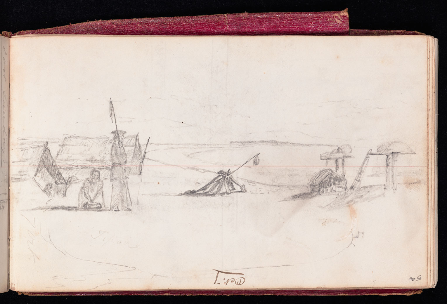
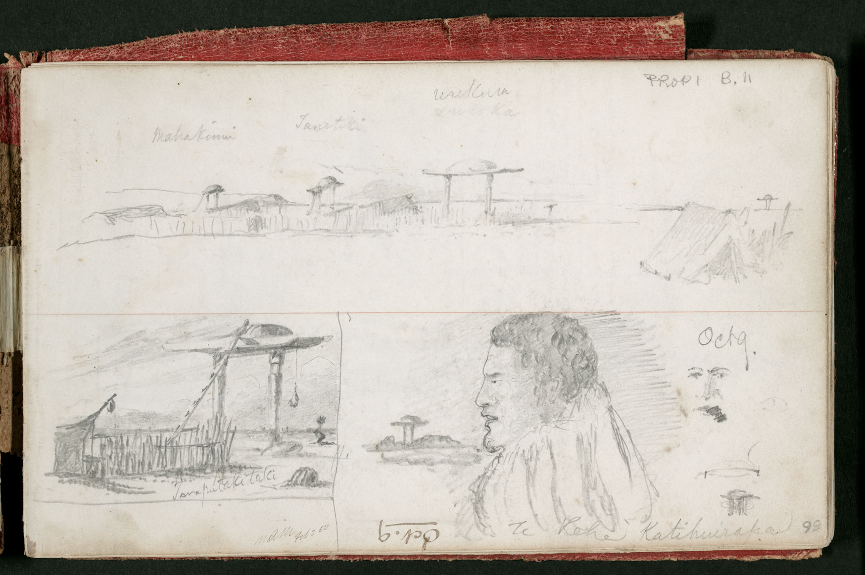
Travelling South to North: Tarawhata and Poua guide Edward Shortland 1844

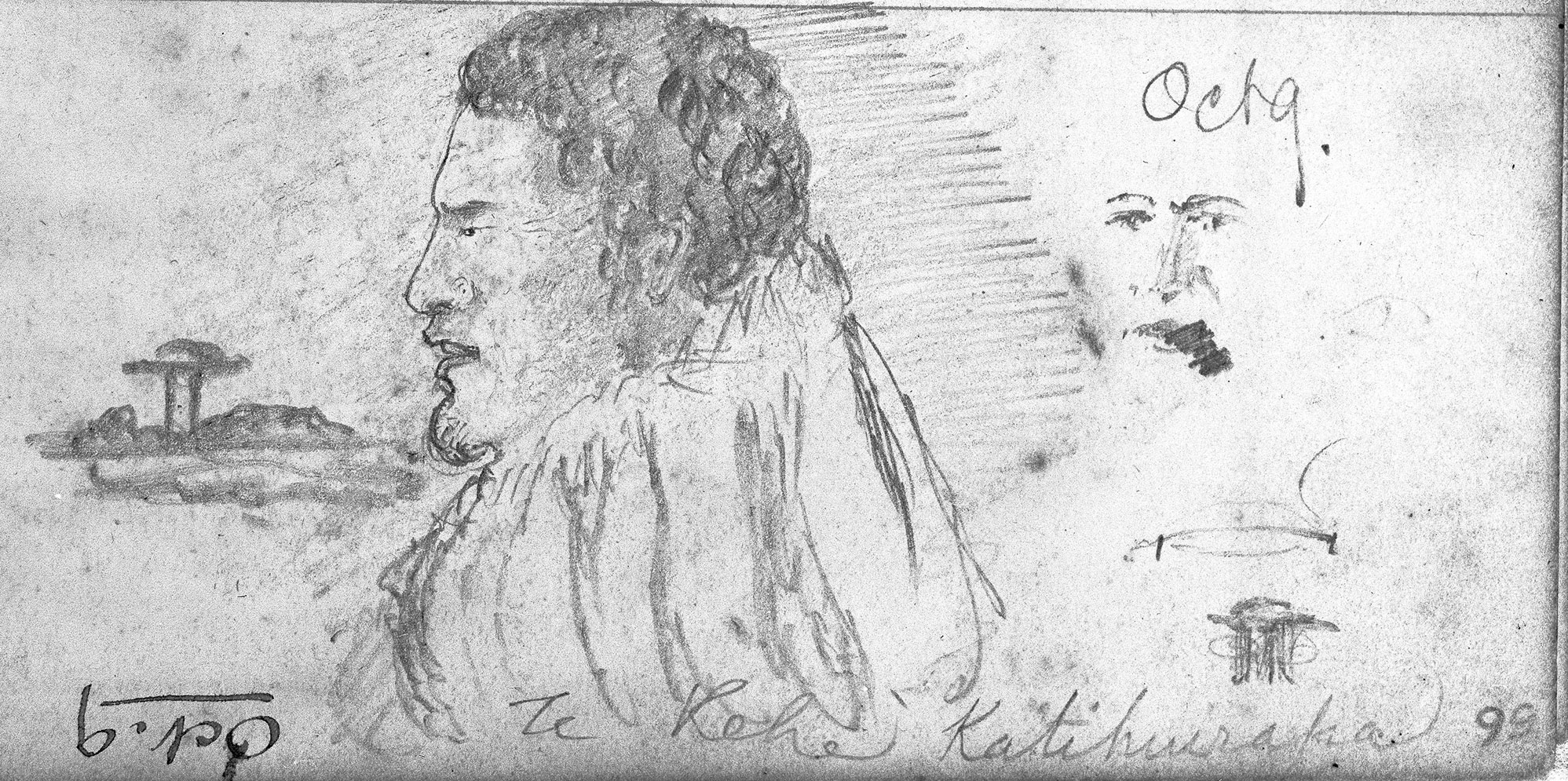
In the summer of 1843-44, Edward Shortland (Protector for the Aborigines) travelled the length of the east coast of Te Waipounamu undertaking a census of the southern Māori population. Accompanied by two Māori guides from the North Island, Shortland’s party was also joined by several different Ngāi Tahu guides on various legs of the journey. Among these guides were Poua and Tarawhata, the sons of the Kāti Huirapa rangatira (chief), Te Rehe.

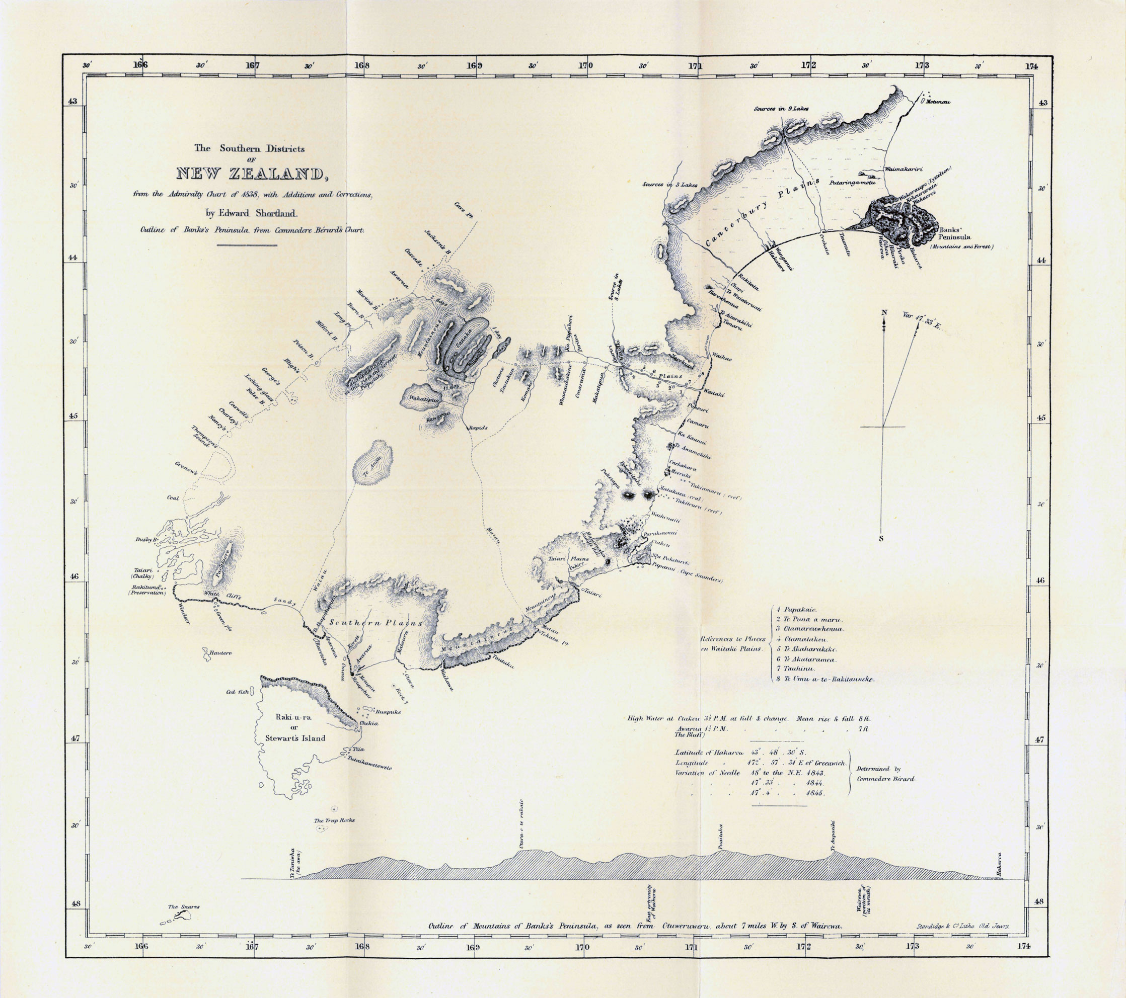
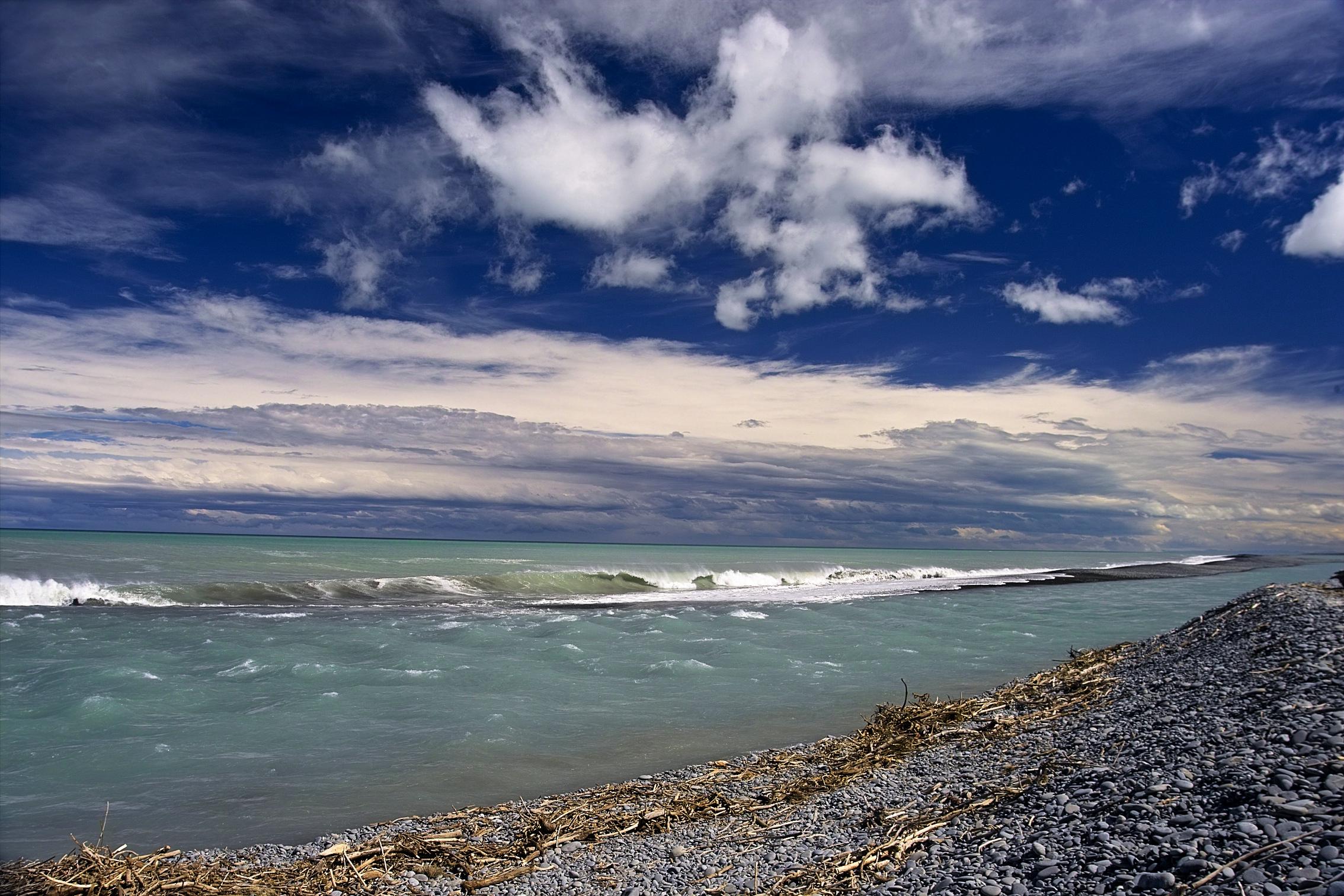
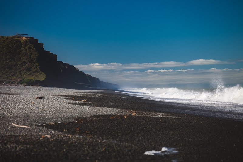
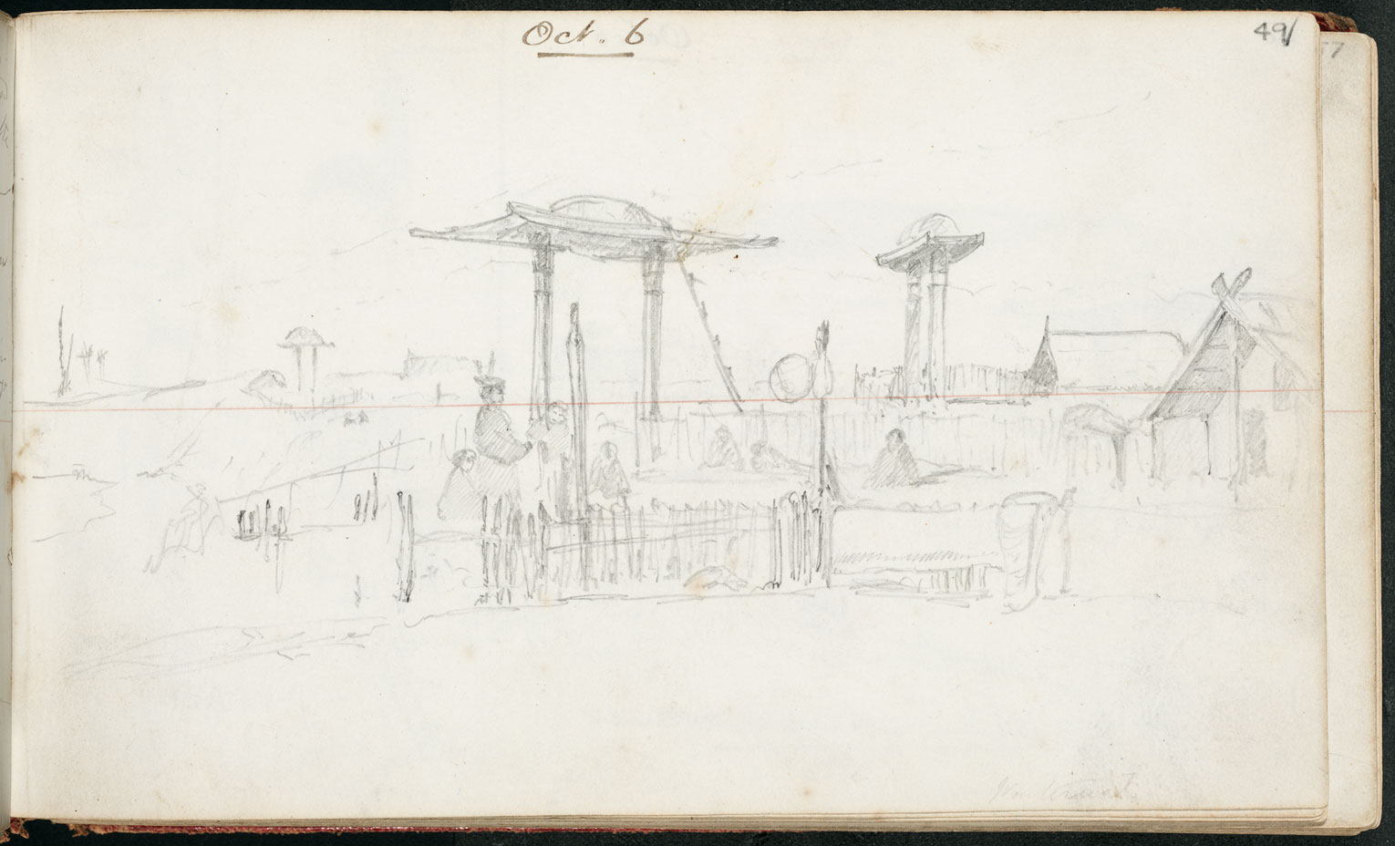
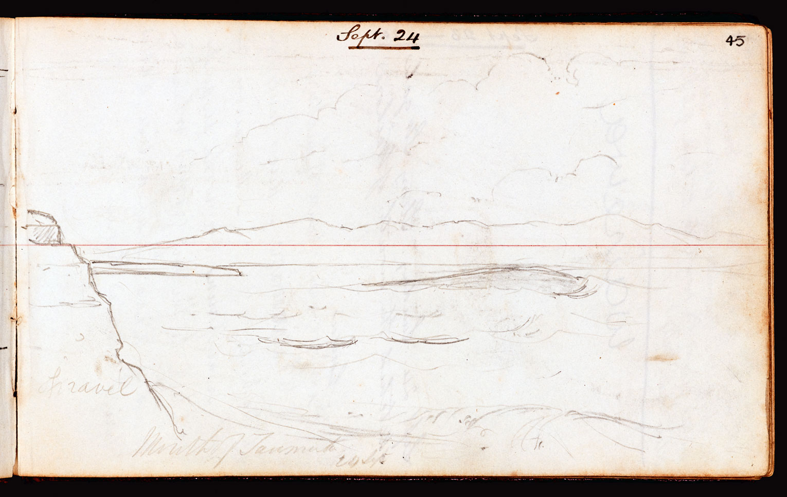
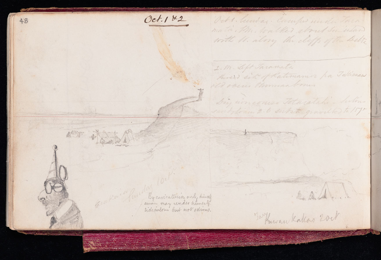
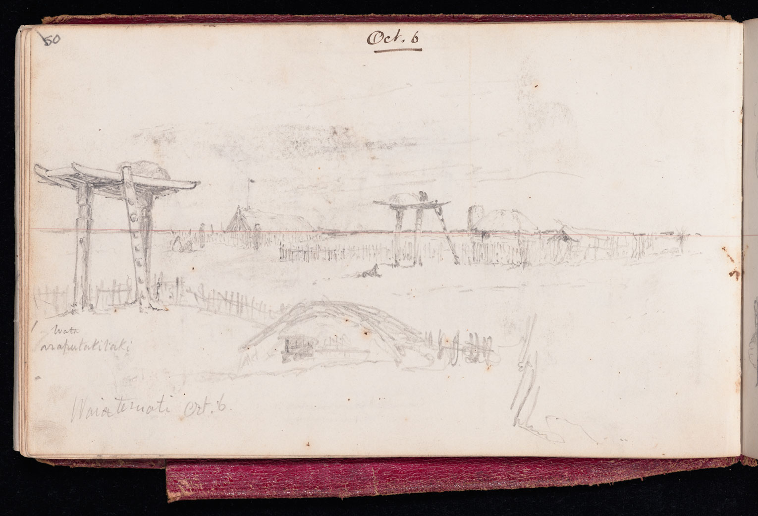
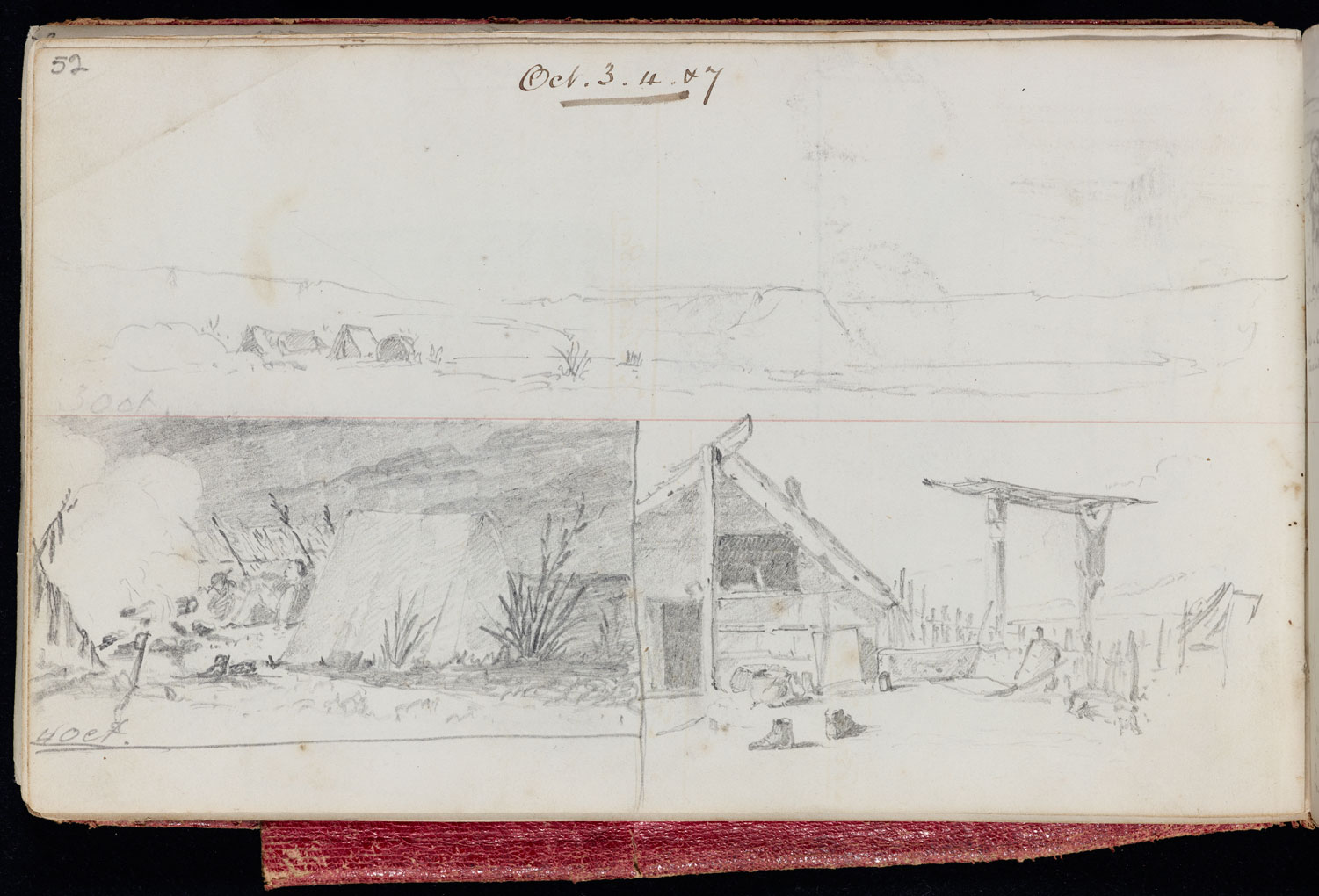
Poua escorted Shortland from Waikouaiti northward to the commencement of the ninety mile beach at Te Aitarakihi. From there, Te Rehe himself took over as guide, leading the party on to lake Waitarakao where his wife prepared them a meal of fish and potatoes before they proceeded inland to Te Waiateruatī pā on the Ōrakipaoa River for the night. In exchange for payment of a blanket, Tarawhata then assumed guiding duties for the remainder of the journey north.

Setting out from Te Waiateruatī pā, Tarawhata and Shortland travelled past the Ōhapi River where they feasted on tuna (eels) before camping at the Rangitata. The following evening an island in the middle of the seasonally dry bed of the Hakatere (Ashburton River) served as their campsite. On reaching the Whakanui, they  filled water bottles left purposely on the banks for travellers as there was no fresh water between there and the Rakaia, a day’s travel away. This ‘desert’ leg of the journey was best undertaken very early or late in the day to avoid the risk of dehydration.

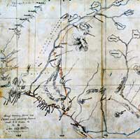
As they travelled, Tarawhata shared his extensive knowledge of the geography of the area with Shortland who was surprised to find that there were Māori names given to many small streams and ravines which he perceived were scarcely worthy of notice. Tarawhata also described and named the interior sources of the Rangitata and Rakaia Rivers.

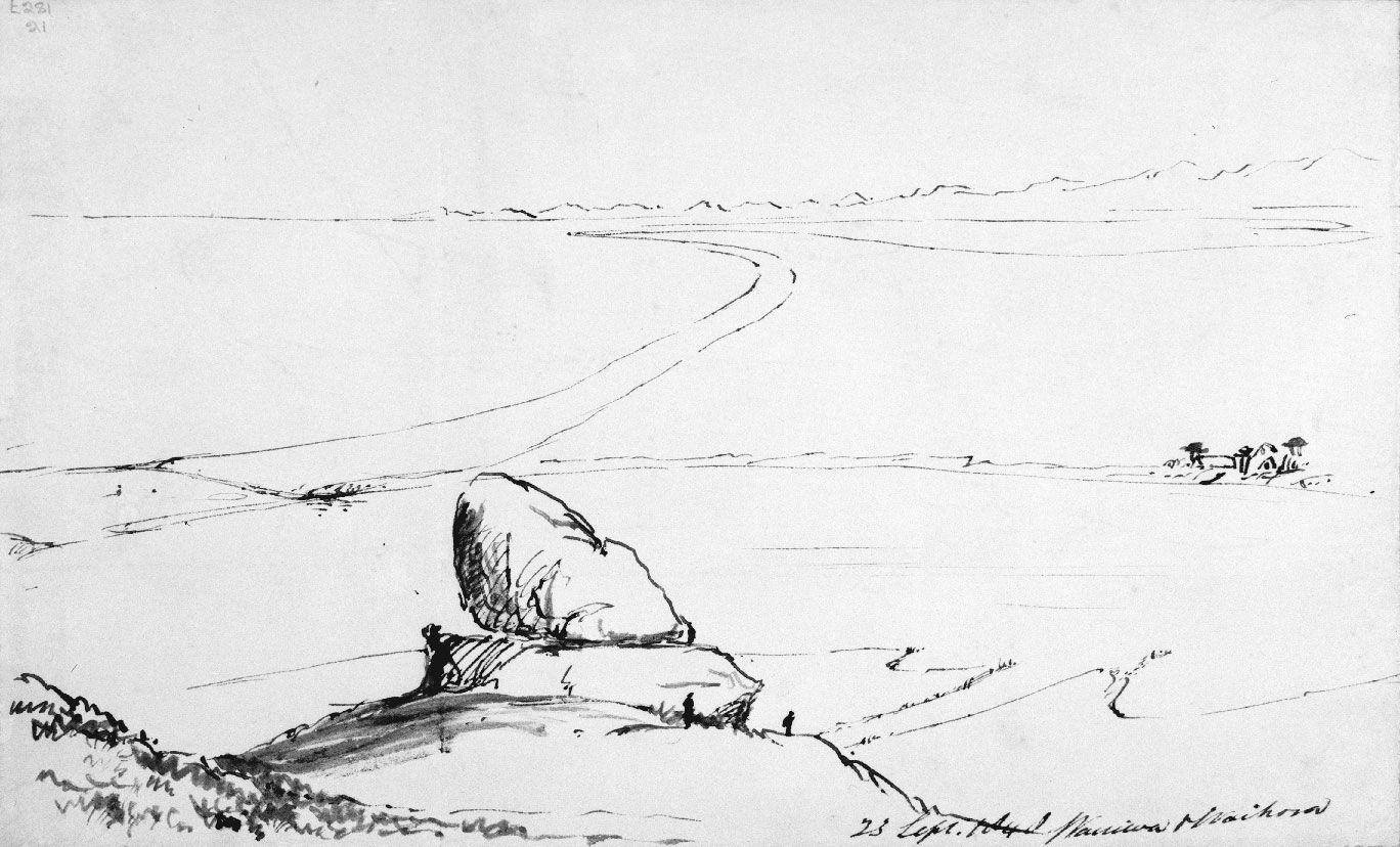
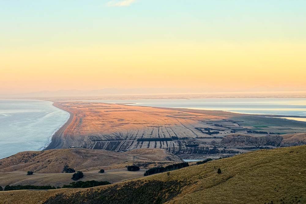
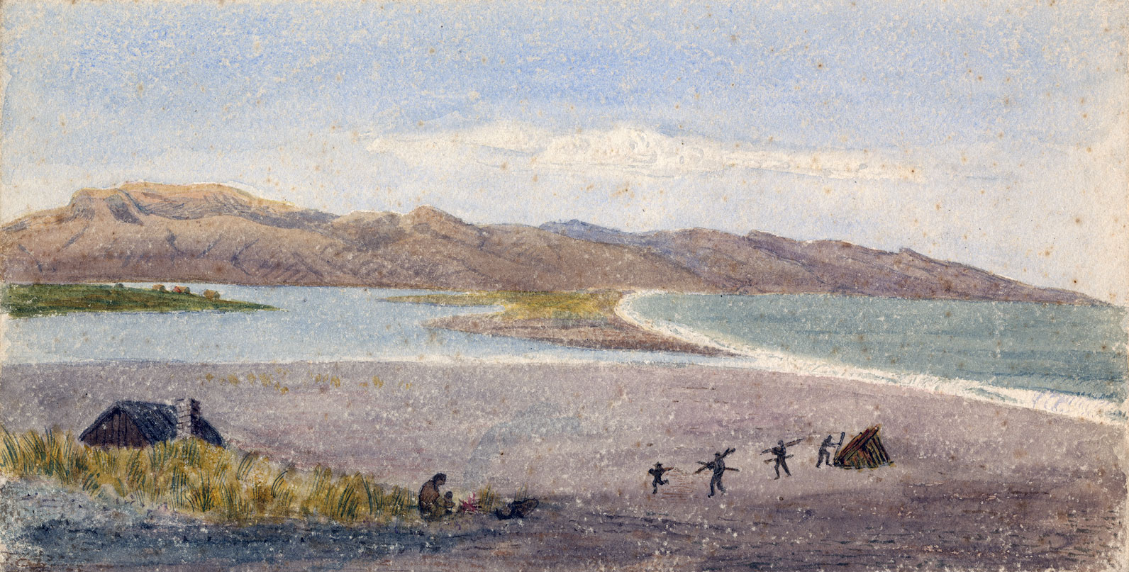
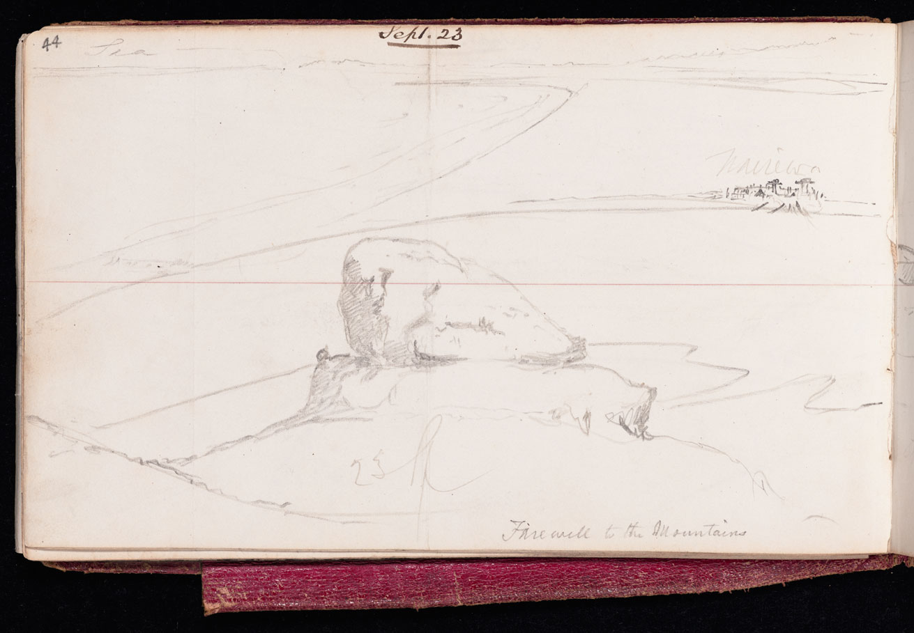
From the Rakaia to the kāinga of Taumutu,  Shortland and his party sustained themselves solely on kāuru, a nutritious sweet food produced from the cooked stems and roots of the tī kōuka (cabbage tree). The final stretch of the journey took the party along Kaitōrete, the large shingle bank separating Te Waihora (Lake Ellesmere) from Te Moana-nui-a-Kiwa (the Pacific Ocean). The hard relatively barren surface of Kaitōrete made for easy travelling. Ahead rose the peaks of Te Pātaka-a-Rākaihautū with Wairewa (Lake Forsyth) at its base and thence, the cliffy terminus of the ninety mile beach.

After walking for half-an-hour across an open down, we arrived at Te Aitara-kihi—the commencement of what is called by the whalers the ninety-mile beach—which extends from this point, in one unbroken line, to Banks's Peninsula.

- Edward Shortland, 1844

“Just as we were leaving the place Te Rehe brought us a basket of “kauru,” or baked root of the “ti” for which Waiateruati is celebrated. This root is in shape like a carrot, but from two to three feet long, and requires a deep and rich soil for its growth.”

Edward Shortland, 1844.

“In the morning we went on a short distance to Whakanui or Hakanui, meaning the great halting place, and remained there by the advice of our guide till the afternoon. Between this place and the river Orakaia, a distance of about twenty-five miles, there is no fresh water to be obtained, except in the winter months. It thus became necessary to carry water with us; and, since by avoiding the heat of the day we should require a smaller quantity, we rested till the sun began to decline, taking advantage of the shelter of a good hut built here for the convenience of travellers.”

Edward Shortland, 26 January 1844

Our path during the whole day had been hard and good, so that we arrived early in the afternoon at the native station near the lake Wairewa, which runs in a north-easterly direction, between two ranges of lofty hills in the Peninsula. Here we were welcomed by two small families, numbering only ten persons.

Edward Shortland, 29 January 1844.

Travelling North to South: Tarawhata and Te Rehe guide Walter Mantell 1848

Te Rehe was a Kāi Tahu leader in the 19th century. Te Rehe and his sons regularly guided surveyors and government agents through the South Canterbury region and hosted them at Te Waiateruatī pā on the Ōrakipaoa River.

Four years after Shortland’s journey, Tarawhata and Te Rehe were part of another party which guided Walter Mantell (Commissioner for Extinguishing Native Claims) along the ninety mile beach from Waitarakao to Wairewa from 23 September to 17 October 1848. Mantell’s sketchbooks and journals dating from this period, provide one of the earliest visual records of the landscape and kāika of Te Waipounamu. Mantell’s description of his travels also provides insights to the  Ngāi Tahu people and places he encountered.

Mantell is a contentious figure in Ngāi Tahu history. He was responsible for negotiating and surveying the Ngāi Tahu reserves following the Crown purchases of Ngāi Tahu lands in the Canterbury region. The swindles that ensued are infamous, and had devastating consequences for Ngāi Tahu who lost not only their land but also access to food and resources.

Read the journal and view the sketches and survey plans produced by Walter Mantell during his trip from Wairewa to Waitarakao in September and October 1848.

This sketch of Te Rehe was drawn by Walter Mantell (Commissioner for Extinguishing Native Claims) at Te Waiateruatī on 9 October 1848. E-334-056, Alexander Turnbull Library

<p>Walter Mantell's sketchbook,&nbsp;depicting scenes of Banks Peninsula and further south along the East Coast of the South Island to Waitaki, made during Mantell's travels through the South Island as Commissioner for the Extinguishment of Native Titles, in 1848. <em>Mantell, Walter. Sketchbook&nbsp;no.3 1848-49. E-334, Alexander Turnbull Library</em></p>

Walter Mantell’s sketchbook

View gallery