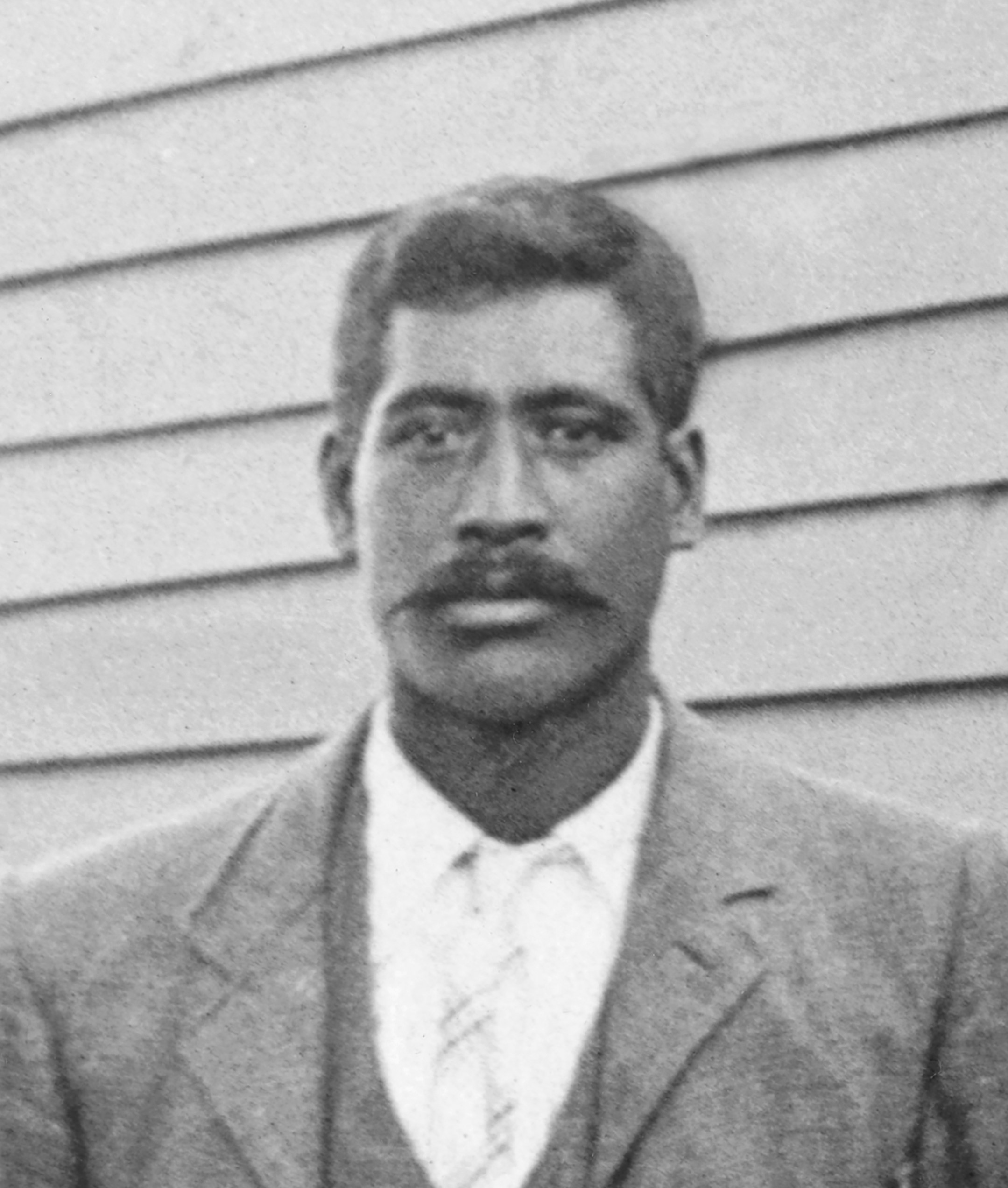
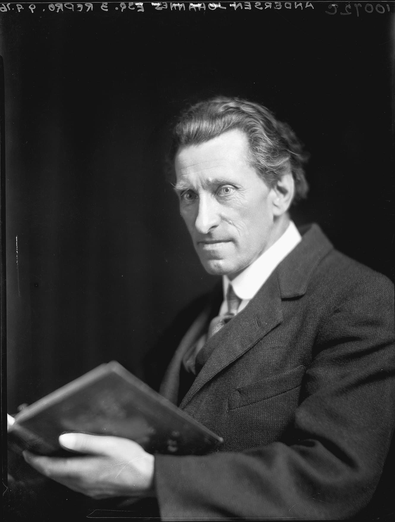
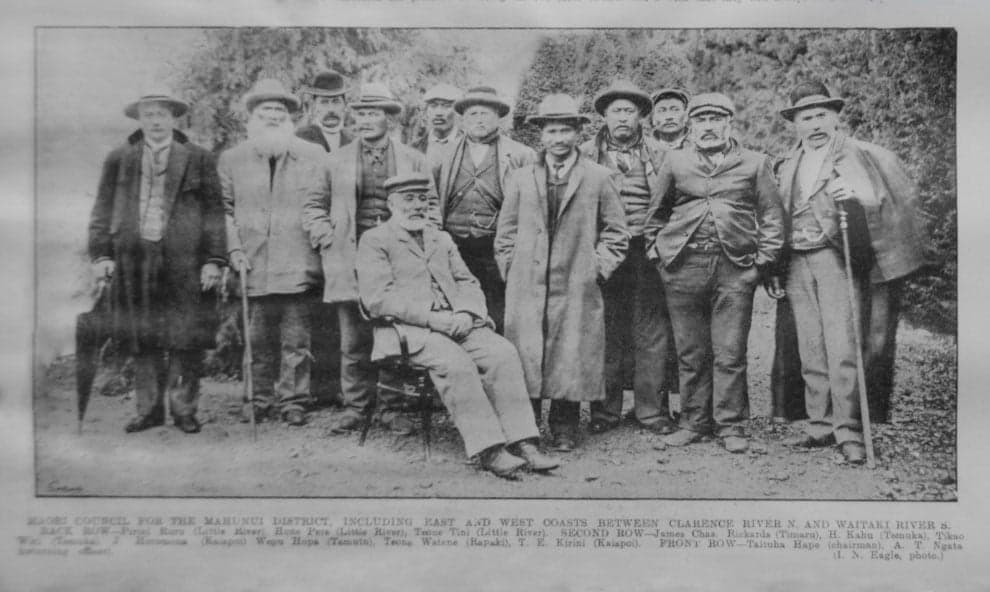
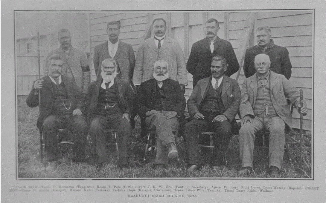
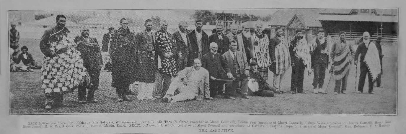
Ngāi Tahu – Cultural Mapping Project

Southern Bays of Banks Peninsula

Hone Tututaua Pere and Hoani Te Hau Pere Map, 1908

This map of Māori place names for the southern bays of Te Pataka-o-Rākaihautū (Banks Peninsula) is based on information provided by Hoani Te Hau Pere and his father Hone Tututaua Pere. Both men were key advocates for the local Ngāi Tahu hapū of Ngāti Makō and Ngāti Irakehu on Banks Peninsula. In 1908 at Kaiapoi, Taare Parata (the son of southern Ngāi Tahu leader Tame Parata) verbally obtained detailed descriptions of the Māori place names and their associated meanings for the bays between Akaroa Harbour and Wairewa (Lake Forsyth) from Hoani and his father. Taare Parata then shared this map with ethnologist Johannes Andersen at the Department of Lands and Survey. In 1927 Andersen published the place names in his book Place Names of Banks Peninsula: A topographical history. This map was only recently rediscovered among Andersen's papers at the Auckland War Memorial Museum and has been an invaluable source for Kā Huru Manu.

Hoani Te Hau Pere

Hoani Te Hau Pere of Wairewa (Little River) was a key advocate for the Ngāi Tahu hapū of Ngāti Makō and Ngāti Irakehu in the early twentieth century, and a key informant of the traditional Māori place names of Banks Peninsula. Though there is very little information recorded about his earlier life, he was one of two children born to Hone Tututaua Pere and Keehi Te Hau. Hoani represented Wairewa in various forums, including being an inaugural representative on the Mahaanui Maori Council, and a member of the executive that organised the Māori carnival at Lancaster Park to raise funds for the council.  When George Robinson (Teoti Rapatini), the respected Ngāi Tahu leader of Wairewa, passed away in 1906, Hoani succeeded him, fulfilling a crucial role as a representative of the Ngāi Tahu hapū of Banks Peninsula in various forums.

Hoani Te Hau Pere. Ngaitahu Maori Trust Board Collection, Ngāi Tahu Archive, 2018-0462-1

<p>Ngāi Tahu representatives at Arowhenua Marae to discuss the South Island Landless Natives Act. Hoani Te Hau Pere is second from the left in the back row, and Taare Parata is third from the left in the third row.</p>
<p><strong>Back row:</strong> Wiwi Taiaroa, Hamuera Torepe, Hoani Korehe Kaahu, Hamuera Te Au Mutu Rupene, Ihaia Taoka Whaitiri, Apera Pirini Ruru, Hoani Te Hau Pere.&nbsp;<strong>Third row:</strong> Hare Taura, Matiu Te Hu Erueti, Taituha Hape, Teone Matapura Ellison, Te Harawira Keepa, Taare Rakatauhake Parata, Tiemi Rickus, Tiemi Hipi.&nbsp;<strong>Second row:</strong> Eruera Waaka, Kohiku Titi, Tikao Wira, Iraia Waaka.&nbsp;<strong>Front row:</strong> Jack Connor, Kurupōhatu Ruru, Teone Taare Tikao, Thomas Eustace Green, John Hopere Wharewiti Uru, Wiremu Mihaka, Hoani Maaka, Hemi Tano Paiki, Kaitai Pahii.</p>
<p><em>Courtesy of&nbsp;Christchurch City Libraries, CCL-PhotoCD07-IMG0010</em></p>
<p>Click <a rel="noopener" href="https://kareao.nz/scripts/mwimain.dll/144/ANON_DESCRIPTION/WEB_DETAIL_DESCRIPTION_REPORT?SESSIONSEARCH&amp;exp=sisn%2015475" target="_blank" title="Arowhenua 1907 hui">here</a> to read more information about this image on Kareao</p>

Images of Hoani Te Hau Pere

View gallery

Taare Parata

Taare Rakatauhake Parata (1865 -1918), also known as Charles Rere Parata was born at Puketeraki in 1865, the son of Tame Parata (later the MP for Southern Maori) and his wife Peti Hurene, also known as Elizabeth Brown. His paternal grandfather was Captain Pratt, a whaler from Massachusetts. In 1896, Parata was a working for the Native Land Court as a clerk and licensed interpreter. He married Katherine Te Rongokahira Asher (Te Arawa) and together they had three children. The couple strongly supported the manifesto of what become the Young Māori Party. They often spent time in Wellington where Parata set up a Māori language school after they moved there permanently in 1905. He left his position with the Native Land Court and joined William Moffatt in business as land and estate agents, interpreters and native agents. Following his father's elevation to the Legislative Council in 1911, Parata succeeded his father as Member of Parliament for the Southern Maori electorate and held the seat until 1918, when he died in Wellington.

Taare Rakatauhake Parata recorded the Maori place names for the southern bays of Banks Peninsula in 1908 from Hone Tututaua Pere and Hoani Te Hau Pere. Te Rūnanga o Ngāi Tahu Collection, Ngāi Tahu Archive, 2017-0251

Taara Parata records place names from Hone Tututaua Pere and Hoani Te Hau Pere

On 25 November 1908 at Kaiapoi Taare Parata verbally obtained from Hoani Te Hau Pere and his father Hone Tututaua Pere detailed descriptions of the Māori place names and their associated meanings for the bays along the southern coastline of Banks Peninsula between Akaroa Harbour and Wairewa (Lake Forsyth). Hoani and Taare already knew each other. In the previous year they both attended a major hui of Ngāi Tahu and Ngāti Māmoe representatives at Arowhenua to discuss the recently passed South Island Landless Natives Act. At the time Taare recorded this information Hone Tututaua Pere was described ‘as an old Native of Little River’ and passed away a short time later in 1911.

Click here to view the map on Kareao.

Map of Māori place names for the southern bays of Te Pataka-o-Rākaihautū (Banks Peninsula) provided by Hoani Te Hau Pere and Hone Tututaua Pere. MS7, Auckland Memorial War Museum

Johannes Andersen

Taare Parata passed the information he gathered from Hoani Te Hau Pere and Hone Tututaua Pere onto ethnologist Johannes Andersen at the Christchurch office of the Department of Lands and Survey. Andersen was born in Denmark and emigrated to New Zealand with his family as a child. He wrote poetry, studied New Zealand flora and fauna, and pursued an interest in Māori mythology. He worked for the Department of Lands and Survey in Christchurch from 1887 until 1915. During this period he acquired a wealth of topographical knowledge and developed an avid interest in toponymy - the study of place names, both Māori and Pākehā.

This was part of a much larger effort of the Department to actively gather and preserve local Māori place names as directed by the Surveyor General Stevenson Percy Smith in 1893. Andersen later published the place names provided by Hoani Te Hau Pere and Hone Tututaua Pere in his 1927 publication Place Names of Banks Peninsula: A Topographical History. In this publication Andersen recorded Hoani Te Hau Pere's name as Tama-peri and Hone Tututaua Pere as Tu-tu-taua.

Johannes Andersen. Photograph by Stanley P. Andrew, Alexander Turnbull Library, 1/1-018551;F

Herries Beattie interviews Hoani Te Hau Pere

James Herries Beattie (1881 - 1972), known as Herries, was the most prolific collector of Ngāi Tahu histories, place names and traditions. Born at Gore to to Scottish immigrant parents, Beattie developed from an early age a wide-ranging and lasting interest in the traditional lifestyle and history of Ngāi Tahu in southern New Zealand. Beattie developed a passion for Kāi Tahu and Kāti Māmoe history with his work published by regional newspapers and journals of the Polynesia Society and New Zealand Institute. In 1920 the Otago Museum funded an ethnological research project which enabled Beattie to visit and interview kaumātua in several kāika throughout Te Waipounamu. On a salary of £5 per week Beattie travelled by train and bicycle to isolated Ngāi Tahu communities to interview Ngāi Tahu people.

As part of this research project Beattie travelled to Banks Peninsula in September 1920. He initially stayed with Riki Te Mairaki Taiaroa at Taumutu where he first met Hoani Te Hau Pere at the nearby fishing camp on Te Waihora (Lake Ellesmere). During Beattie’s two day visit at Taumutu, he gathered information from Hoani about the Māori lore of tuna (eel), pātiki (flounders) and other fish, and the traditional Māori place names of Banks Peninsula. When Beattie travelled onwards to Akaroa, he visited Hoani at Wairewa to interview him again. Beattie described Hoani as ‘a big intelligent Māori’. The excerpt below is from one of Herries Beattie's notebook outlining the Māori place names that he recorded from Hoani on 30 September 1920. Beattie published these place names in his 1945 publication Maori Placenames of Canterbury.

James Herries Beattie. Courtesy of the Hocken Library, ex MS 582/R/16

Picture

An excerpt from one of James Herries Beattie's notebook outlining the Māori place names that Beattie recorded from Hoani Te Hau Pere on 30 September 1920. MS-582/E/13, Hocken Library, University of Otago

<p><a href="http://www.kahurumanu.co.nz/atlas?find={30666c68-3f52-e311-8212-005056970030}" title="Pareaihe">Pareaihe</a>, commonly known as Te Oka, is one of the southern bays of Horomaka/Te Pātaka‐a‐Rākaihautū (Banks Peninsula) 
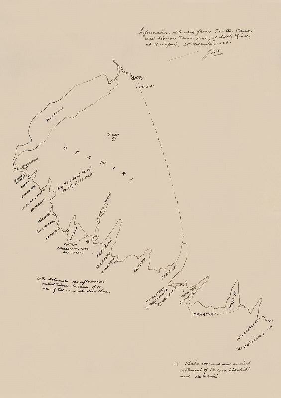
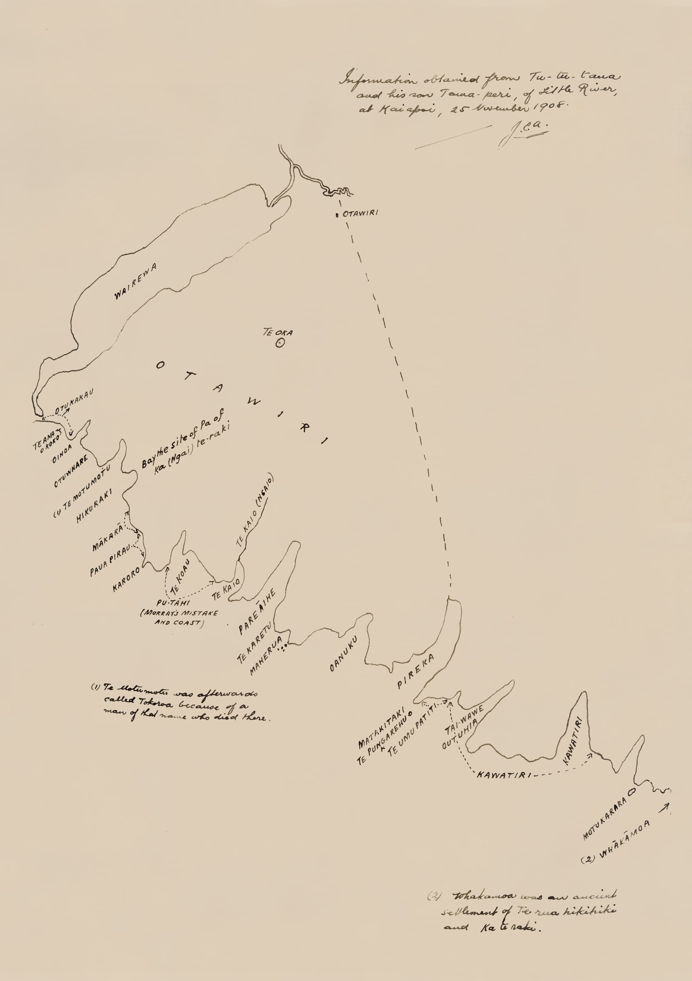
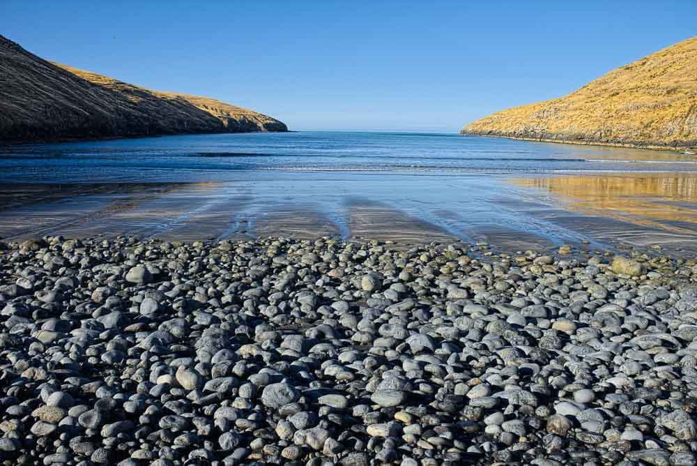
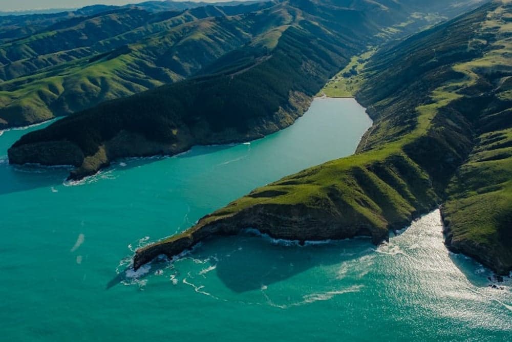
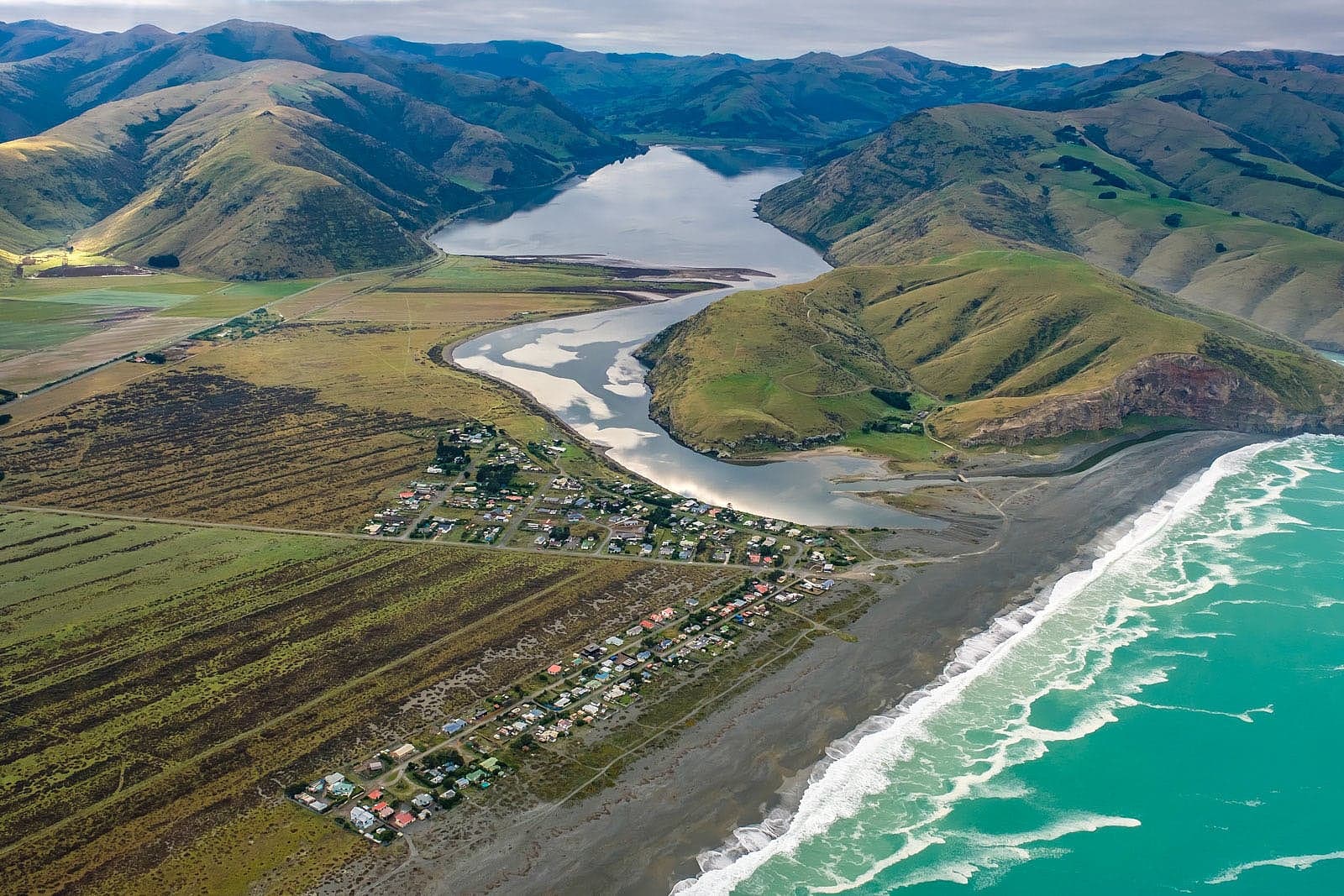
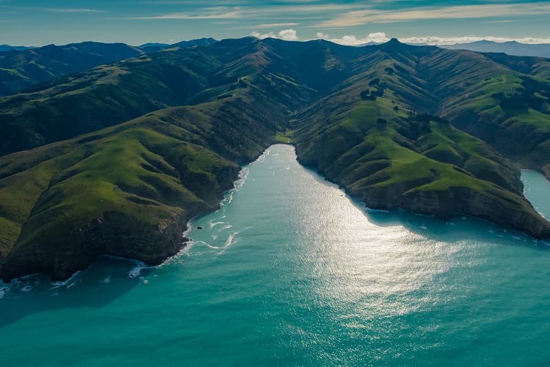
and forms part of the coastline between the outlet of Wairewa (Lake Forsyth) and the entrance to Akaroa Harbour. The name Te Oka refers to a peak above Pareaihe. The southern bays were all occupied by Ngāi Tahu at various times. The area was also associated with some the earliest interactions between Ngāi Tahu and Pākehā in the Canterbury region when whaling stations were established at other southern bays including Pireka (Peraki), Hikuraki, Ōihowa (Oashore), and Whangakai (Island Bay) in the 1830s.</p>
<p><em>Te Rūnanga o Ngāi Tahu Collection, Ngāi Tahu Archive, 2015‐221</em></p>

Wāhi ingoa for bays on the southern coastline of Banks Peninsula

View gallery